Greenville night lights from space
Night Light of Greenville (South Carolina) from space (United States) Src. Average luminocity for 10x10km area is 94.4469% and for 50x50km: 45.9086%.
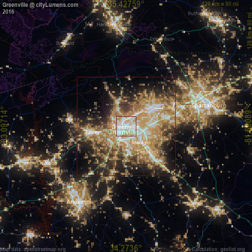
Analysis of Greenville night lights 2016
Square area 10x10 km:
 39.93%
90-99
35.53%80-89
16.3%70-79
6.59%60-69
1.65%50-59
0%40-49
0%30-39
0%20-29
0%10-19
0%0-9
0%Square area 50x50 km:
6.1%90-99
6.32%80-89
8.74%70-79
9.35%60-69
9.33%50-59
6.37%40-49
6.37%30-39
7.82%20-29
8.55%10-19
12.14%0-9
18.91%Clear (daylight) street map image can be seen on geolist.org.
Map coordinates:
35° 25' 39.3" North, 83° 5' 49.7" West
34° 51' 9.4" North, 82° 23' 38.4" West
34° 16' 25" North, 81° 41' 27.2" West
Some cities around Greenville sort by population:
• Mauldin
11.2 km =7 mi,  137°
137°
• Wade Hampton
7.9 km =4.9 mi,  44°
44°
• Berea
6.7 km =4.2 mi,  302°
302°
• Gantt
6.5 km =4 mi,  205°
205°
• Parker
5.4 km =3.4 mi,  267°
267°
• Sans Souci
3.9 km =2.4 mi,  315°
315°
• Powdersville
11.3 km =7 mi,  233°
233°
• Welcome
5 km =3.1 mi, 234°
4580543 (p: 64,579)
Sources (retrieved 2019-11-25):
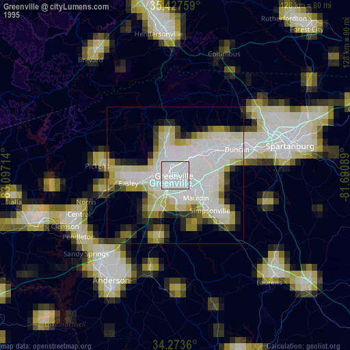
» NASA, Earths city lights 1995
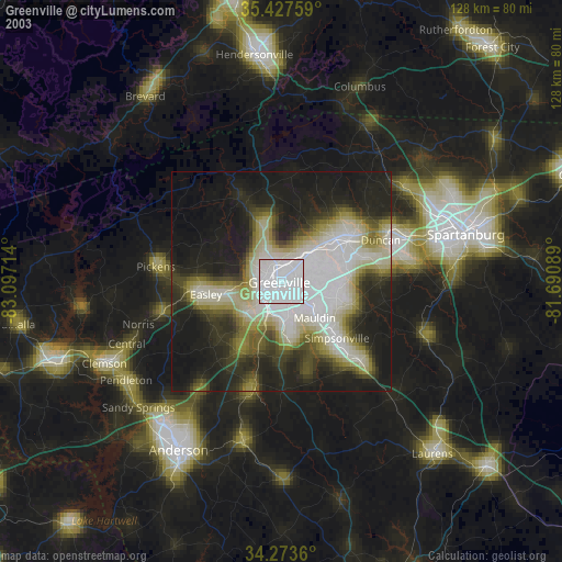
» NASA city lights 2003
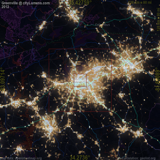
» Earth at Night: Flat Maps 2012, 2016