Five Forks night lights from space
Night Light of Five Forks (South Carolina) from space (United States) Src. Average luminocity for 10x10km area is 71.5055% and for 50x50km: 49.4948%.
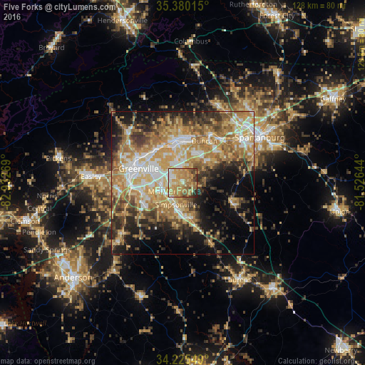
Analysis of Five Forks night lights 2016
Square area 10x10 km:
 5.86%
5.86%90-99
9.16%80-89
19.23%70-79
24.36%60-69
22.16%50-59
7.33%40-49
6.23%30-39
3.66%20-29
2.01%10-19
0%0-9
0%Square area 50x50 km:
6.93%90-99
7.43%80-89
9.34%70-79
10.84%60-69
10.45%50-59
6.34%40-49
5.82%30-39
7.39%20-29
7.19%10-19
10.82%0-9
17.44%Clear (daylight) street map image can be seen on geolist.org.
Map coordinates:
35° 22' 48.5" North, 82° 55' 57.7" West
34° 48' 17.4" North, 82° 13' 46.4" West
34° 13' 31.8" North, 81° 31' 35.2" West
Some cities around Five Forks sort by population:
• Greenville
15.9 km =9.9 mi,  289°
289°
• Greer
14.9 km =9.3 mi,  0°
0°
• Mauldin
7.9 km =4.9 mi,  248°
248°
• Taylors
14.2 km =8.8 mi,  334°
334°
• Simpsonville
7.9 km =4.9 mi,  196°
196°
• Wade Hampton
14.5 km =9 mi,  319°
319°
• Gantt
17.8 km =11.1 mi,  268°
268°
• Fountain Inn
13.2 km =8.2 mi,  166°
166°
4578602 (p: 14,140)
Sources (retrieved 2019-11-25):
» Earth at Night: Flat Maps 2012, 2016