Greenville night lights from space
Night Light of Greenville (Michigan) from space (United States) Src. Average luminocity for 10x10km area is 15.0561% and for 50x50km: 3.1528%.
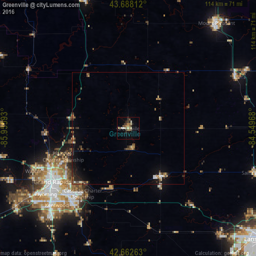
Analysis of Greenville night lights 2016
Square area 10x10 km:
 0.61%
0.61%90-99
2.73%80-89
1.21%70-79
0.91%60-69
3.03%50-59
3.18%40-49
1.82%30-39
3.03%20-29
3.48%10-19
1.82%0-9
78.18%Square area 50x50 km:
0.18%90-99
0.31%80-89
0.38%70-79
0.23%60-69
0.48%50-59
0.59%40-49
0.54%30-39
0.59%20-29
0.96%10-19
2%0-9
93.75%Clear (daylight) street map image can be seen on geolist.org.
Map coordinates:
43° 41' 17.2" North, 85° 57' 21.3" West
43° 10' 39.1" North, 85° 15' 10.1" West
42° 39' 45.5" North, 84° 32' 58.8" West
Some cities around Greenville sort by population:
• Grand Rapids
41.3 km =25.7 mi,  234°
234°
• Forest Hills
31 km =19.3 mi,  218°
218°
• Northview
31.8 km =19.8 mi,  242°
242°
• Ionia
25.8 km =16 mi,  145°
145°
• East Grand Rapids
39.2 km =24.4 mi, 227°
• Comstock Park
37.2 km =23.1 mi,  245°
245°
• Rockford
25.7 km =16 mi,  255°
255°
• Belding
9.1 km =5.7 mi,  167°
167°
4994763 (p: 8,444)
Sources (retrieved 2019-11-25):
» Earth at Night: Flat Maps 2012, 2016