Grand Rapids night lights from space
Night Light of Grand Rapids (Michigan) from space (United States) Src. Average luminocity for 10x10km area is 90.1079% and for 50x50km: 24.059%.
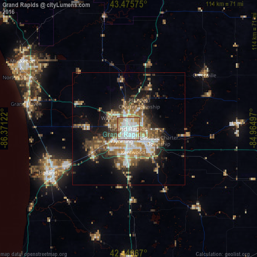
Analysis of Grand Rapids night lights 2016
Square area 10x10 km:
 40.48%
90-99
25.87%80-89
10.95%70-79
9.05%60-69
9.84%50-59
2.54%40-49
1.27%30-39
0%20-29
0%10-19
0%0-9
0%Square area 50x50 km:
4.27%90-99
3.98%80-89
2.68%70-79
2.81%60-69
4.29%50-59
3.89%40-49
4.39%30-39
3.14%20-29
4.75%10-19
10.15%0-9
55.64%Clear (daylight) street map image can be seen on geolist.org.
Map coordinates:
43° 28' 32.7" North, 86° 22' 16.4" West
42° 57' 48.1" North, 85° 40' 5.1" West
42° 26' 48" North, 84° 57' 53.9" West
Some cities around Grand Rapids sort by population:
• Wyoming
6.3 km =3.9 mi,  208°
208°
• Kentwood
10.6 km =6.6 mi,  169°
169°
• Walker
9.2 km =5.7 mi,  297°
297°
• Jenison
11.9 km =7.4 mi,  238°
238°
• Northview
10.7 km =6.6 mi,  30°
30°
• Cutlerville
13.6 km =8.5 mi,  178°
178°
• East Grand Rapids
5.3 km =3.3 mi,  117°
117°
• Comstock Park
8.4 km =5.2 mi,  358°
358°
4994358 (p: 195,097)
Sources (retrieved 2019-11-25):
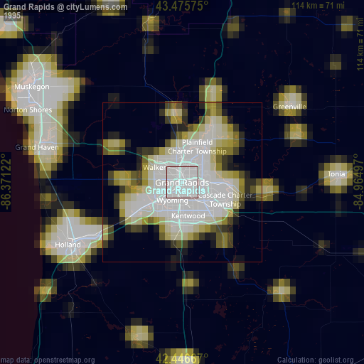
» NASA, Earths city lights 1995
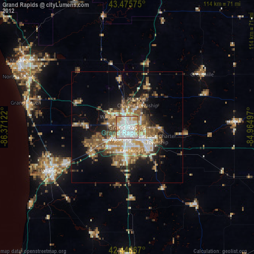
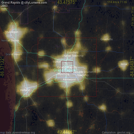
» NASA city lights 2003
» Earth at Night: Flat Maps 2012, 2016