East Grand Rapids night lights from space
Night Light of East Grand Rapids (Michigan) from space (United States) Src. Average luminocity for 10x10km area is 85.9492% and for 50x50km: 23.6294%.
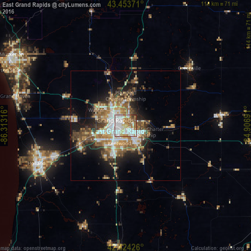
Analysis of East Grand Rapids night lights 2016
Square area 10x10 km:
 36.98%
90-99
22.38%80-89
9.05%70-79
7.14%60-69
14.13%50-59
6.35%40-49
2.7%30-39
1.27%20-29
0%10-19
0%0-9
0%Square area 50x50 km:
4.23%90-99
3.98%80-89
2.69%70-79
2.88%60-69
4.3%50-59
3.76%40-49
4.26%30-39
2.98%20-29
4.64%10-19
9.76%0-9
56.53%Clear (daylight) street map image can be seen on geolist.org.
Map coordinates:
43° 27' 13.4" North, 86° 18' 47.4" West
42° 56' 28.1" North, 85° 36' 36.1" West
42° 25' 27.3" North, 84° 54' 24.9" West
Some cities around East Grand Rapids sort by population:
• Grand Rapids
5.3 km =3.3 mi,  297°
297°
• Wyoming
8.3 km =5.2 mi,  248°
248°
• Kentwood
8.5 km =5.3 mi,  199°
199°
• Forest Hills
10 km =6.2 mi,  78°
78°
• Grandville
12.9 km =8 mi, 254°
• Northview
11.6 km =7.2 mi,  3°
3°
• Cutlerville
12 km =7.5 mi, 201°
• Comstock Park
11.9 km =7.4 mi,  335°
335°
4991600 (p: 11,311)
Sources (retrieved 2019-11-25):
» Earth at Night: Flat Maps 2012, 2016