Goddard night lights from space
Night Light of Goddard (Maryland) from space (United States) Src. Average luminocity for 10x10km area is 83.1071% and for 50x50km: 73.2003%.
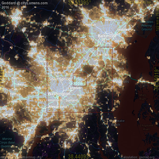
Analysis of Goddard night lights 2016
Square area 10x10 km:
 28.57%
90-99
22.73%80-89
9.74%70-79
16.07%60-69
7.47%50-59
9.09%40-49
3.57%30-39
2.76%20-29
0%10-19
0%0-9
0%Square area 50x50 km:
23.37%90-99
18.48%80-89
10.26%70-79
11.07%60-69
8.87%50-59
7.41%40-49
5.11%30-39
4.5%20-29
3.04%10-19
3.23%0-9
4.67%Clear (daylight) street map image can be seen on geolist.org.
Map coordinates:
39° 32' 2.2" North, 77° 33' 23.2" West
38° 59' 22.4" North, 76° 51' 11.9" West
38° 26' 27.3" North, 76° 9' 0.7" West
Some cities around Goddard sort by population:
• Greenbelt
2.5 km =1.6 mi,  310°
310°
• Lanham-Seabrook
2.4 km =1.5 mi,  175°
175°
• Seabrook
2.5 km =1.6 mi,  166°
166°
• Glenn Dale
2.8 km =1.7 mi,  94°
94°
• New Carrollton
3.2 km =2 mi,  226°
226°
• Lanham
2.5 km =1.6 mi,  200°
200°
• Woodlawn
5.5 km =3.4 mi,  216°
216°
• Glenarden
6.7 km =4.2 mi,  186°
186°
4356341 (p: 6,177)
Sources (retrieved 2019-11-25):
» Earth at Night: Flat Maps 2012, 2016