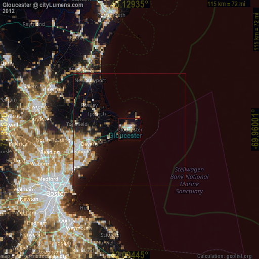
Gloucester night lights from space
Night Light of Gloucester (Massachusetts) from space (United States) Src. Average luminocity for 10x10km area is 20.4848% and for 50x50km: 9.6107%.
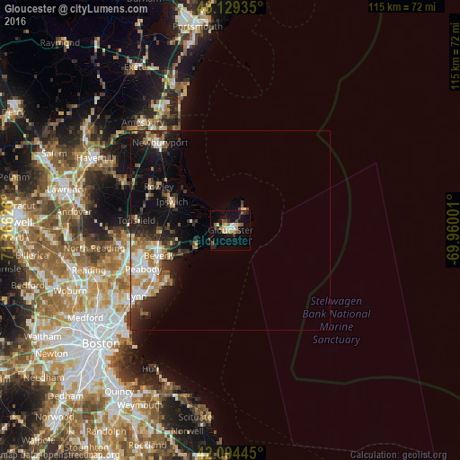
Analysis of Gloucester night lights 2016
Square area 10x10 km:
 1.67%
1.67%90-99
2.27%80-89
4.55%70-79
2.42%60-69
1.82%50-59
3.03%40-49
2.27%30-39
3.03%20-29
3.33%10-19
18.03%0-9
57.58%Square area 50x50 km:
1.44%90-99
1.72%80-89
0.95%70-79
1.15%60-69
1.42%50-59
1.17%40-49
1%30-39
1.62%20-29
3.08%10-19
5.57%0-9
80.89%Clear (daylight) street map image can be seen on geolist.org.
Map coordinates:
43° 7' 45.7" North, 71° 21' 58.5" West
42° 36' 50.6" North, 70° 39' 47.3" West
42° 5' 40" North, 69° 57' 36" West
Some cities around Gloucester sort by population:
• Peabody
23.8 km =14.8 mi,  246°
246°
• Salem
21.8 km =13.5 mi,  241°
241°
• Beverly
18.8 km =11.7 mi, 250°
• Beverly Cove
17 km =10.6 mi, 246°
• Danvers
22.3 km =13.9 mi,  258°
258°
• Marblehead
20.4 km =12.7 mi,  231°
231°
• Swampscott
26.2 km =16.3 mi, 232°
• Manchester-by-the-Sea
9.5 km =5.9 mi, 245°
4937829 (p: 29,781)
Sources (retrieved 2019-11-25):
» Earth at Night: Flat Maps 2012, 2016