Beverly Cove night lights from space
Night Light of Beverly Cove (Massachusetts) from space (United States) Src. Average luminocity for 10x10km area is 47.2778% and for 50x50km: 28.9483%.

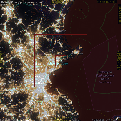
Analysis of Beverly Cove night lights 2016
Square area 10x10 km:
 9.52%
9.52%90-99
9.84%80-89
4.76%70-79
5.56%60-69
8.57%50-59
3.81%40-49
8.1%30-39
9.37%20-29
12.22%10-19
12.86%0-9
15.4%Square area 50x50 km:
7.72%90-99
5.69%80-89
3.34%70-79
4.07%60-69
4.28%50-59
3.22%40-49
2.86%30-39
3.13%20-29
4.65%10-19
7.26%0-9
53.78%Clear (daylight) street map image can be seen on geolist.org.
Map coordinates:
43° 4' 9.2" North, 71° 33' 24.4" West
42° 33' 12.3" North, 70° 51' 13.2" West
42° 1' 60" North, 70° 9' 1.9" West
Some cities around Beverly Cove sort by population:
• Lynn
12.4 km =7.7 mi,  219°
219°
• Peabody
6.8 km =4.2 mi,  245°
245°
• South Peabody
9.2 km =5.7 mi,  238°
238°
• Salem
5.2 km =3.2 mi, 223°
• Danvers
6.7 km =4.2 mi,  291°
291°
• Marblehead
5.9 km =3.7 mi,  183°
183°
• Swampscott
10.6 km =6.6 mi,  209°
209°
• Manchester-by-the-Sea
7.5 km =4.7 mi,  68°
68°
4930511 (p: 40,365)
Sources (retrieved 2019-11-25):
» Earth at Night: Flat Maps 2012, 2016