Georgetown night lights from space
Night Light of Georgetown (Texas) from space (United States) Src. Average luminocity for 10x10km area is 52.208% and for 50x50km: 27.2255%.
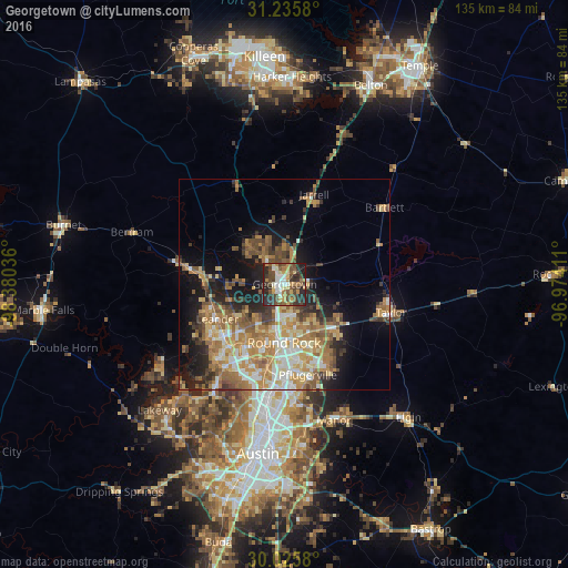
Analysis of Georgetown night lights 2016
Square area 10x10 km:
 6.12%
6.12%90-99
7.17%80-89
7.69%70-79
6.29%60-69
7.87%50-59
9.97%40-49
16.61%30-39
9.27%20-29
25%10-19
4.02%0-9
0%Square area 50x50 km:
3.17%90-99
3.98%80-89
3.85%70-79
5.22%60-69
6.07%50-59
4.95%40-49
3.88%30-39
3.29%20-29
5.37%10-19
9.74%0-9
50.48%Clear (daylight) street map image can be seen on geolist.org.
Map coordinates:
31° 14' 8.9" North, 98° 22' 49.3" West
30° 37' 57.7" North, 97° 40' 38" West
30° 1' 32.9" North, 96° 58' 26.8" West
Some cities around Georgetown sort by population:
• Round Rock
13.8 km =8.6 mi,  180°
180°
• Cedar Park
19.7 km =12.2 mi,  224°
224°
• Pflugerville
22.2 km =13.8 mi,  165°
165°
• Leander
17.9 km =11.1 mi,  250°
250°
• Hutto
16 km =9.9 mi,  128°
128°
• Brushy Creek
14.5 km =9 mi,  204°
204°
• Jollyville
23.1 km =14.4 mi, 203°
• Wells Branch
20.8 km =12.9 mi, 180°
4693342 (p: 63,716)
Sources (retrieved 2019-11-25):
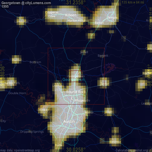
» NASA, Earths city lights 1995
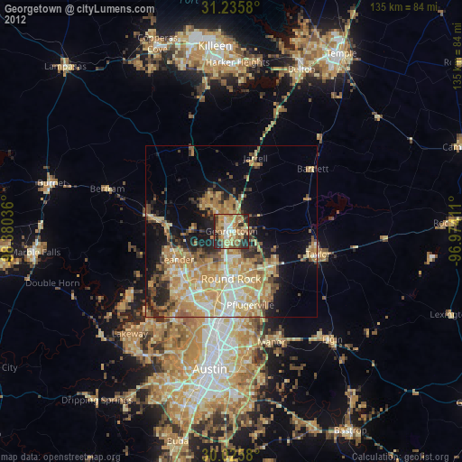
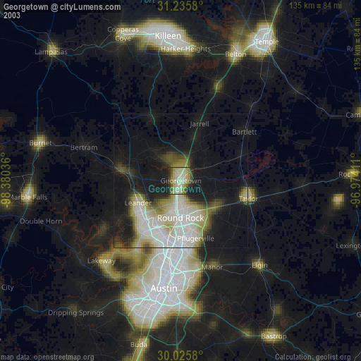
» NASA city lights 2003
» Earth at Night: Flat Maps 2012, 2016