Cedar Park night lights from space
Night Light of Cedar Park (Texas) from space (United States) Src. Average luminocity for 10x10km area is 76.4927% and for 50x50km: 40.9768%.
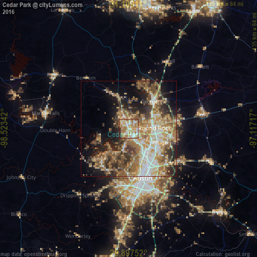

Analysis of Cedar Park night lights 2016
Square area 10x10 km:
 13.55%
90-99
18.32%80-89
13.92%70-79
20.15%60-69
18.32%50-59
8.24%40-49
0.73%30-39
2.01%20-29
4.76%10-19
0%0-9
0%Square area 50x50 km:
5.97%90-99
6.25%80-89
6.03%70-79
6.87%60-69
8.48%50-59
8.09%40-49
6.55%30-39
5.41%20-29
8.19%10-19
10.34%0-9
27.81%Clear (daylight) street map image can be seen on geolist.org.
Map coordinates:
31° 6' 32.8" North, 98° 31' 24.3" West
30° 30' 18.7" North, 97° 49' 13" West
29° 53' 51.1" North, 97° 7' 1.8" West
Some cities around Cedar Park sort by population:
• Round Rock
13.5 km =8.4 mi,  88°
88°
• Georgetown
19.7 km =12.2 mi,  44°
44°
• Leander
8.8 km =5.5 mi,  339°
339°
• Brushy Creek
7.8 km =4.8 mi,  83°
83°
• Jollyville
8.2 km =5.1 mi,  148°
148°
• Wells Branch
15 km =9.3 mi,  115°
115°
• Anderson Mill
5.8 km =3.6 mi,  166°
166°
• Lago Vista
16.9 km =10.5 mi,  252°
252°
4679867 (p: 65,945)
Sources (retrieved 2019-11-25):
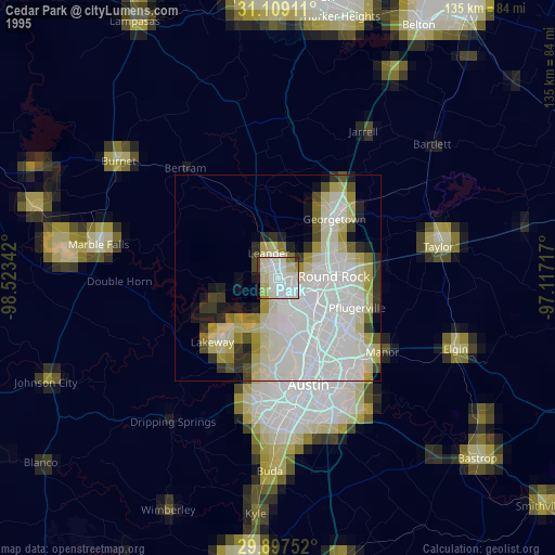
» NASA, Earths city lights 1995
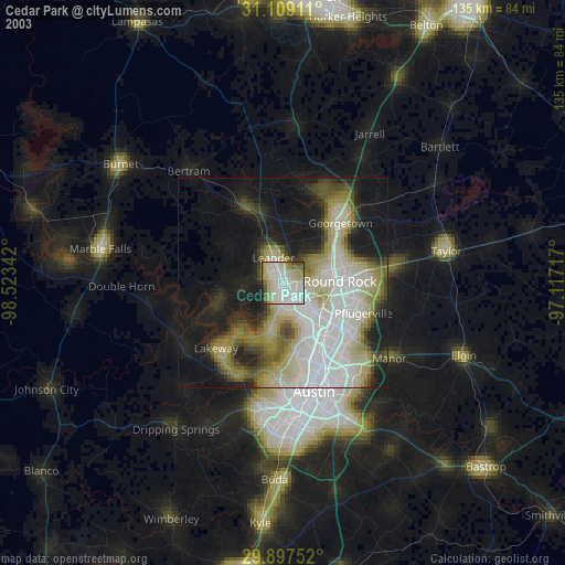
» NASA city lights 2003
» Earth at Night: Flat Maps 2012, 2016