Gastonia night lights from space
Night Light of Gastonia (North Carolina) from space (United States) Src. Average luminocity for 10x10km area is 87.9965% and for 50x50km: 43.232%.
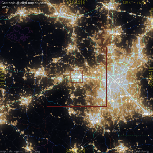
Analysis of Gastonia night lights 2016
Square area 10x10 km:
 30.42%
90-99
30.24%80-89
11.89%70-79
12.76%60-69
8.92%50-59
2.97%40-49
1.75%30-39
1.05%20-29
0%10-19
0%0-9
0%Square area 50x50 km:
5.53%90-99
5.6%80-89
7.74%70-79
7.81%60-69
7.93%50-59
5.78%40-49
7.4%30-39
8.78%20-29
10.35%10-19
16.53%0-9
16.55%Clear (daylight) street map image can be seen on geolist.org.
Map coordinates:
35° 50' 3" North, 81° 53' 25.5" West
35° 15' 43.5" North, 81° 11' 14.3" West
34° 41' 9.4" North, 80° 29' 3" West
Some cities around Gastonia sort by population:
• Mount Holly
16.1 km =10 mi,  75°
75°
• Kings Mountain
14.1 km =8.8 mi,  262°
262°
• Belmont
13.8 km =8.6 mi,  98°
98°
• Lake Wylie
21.5 km =13.4 mi,  142°
142°
• Cherryville
21.7 km =13.5 mi,  306°
306°
• Clover
17.1 km =10.6 mi,  191°
191°
• Bessemer City
9.1 km =5.7 mi,  286°
286°
• South Gastonia
5 km =3.1 mi,  199°
199°
4467732 (p: 74,543)
Sources (retrieved 2019-11-25):
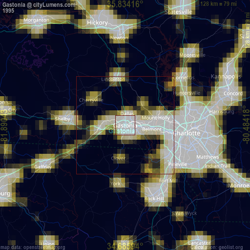
» NASA, Earths city lights 1995
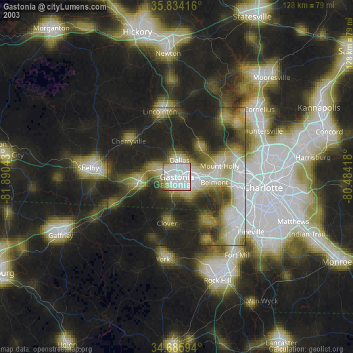
» NASA city lights 2003
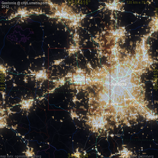
» Earth at Night: Flat Maps 2012, 2016