Bessemer City night lights from space
Night Light of Bessemer City (North Carolina) from space (United States) Src. Average luminocity for 10x10km area is 55.1264% and for 50x50km: 34.9811%.
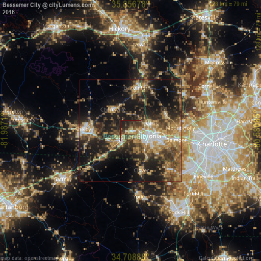
Analysis of Bessemer City night lights 2016
Square area 10x10 km:
 4.03%
4.03%90-99
4.76%80-89
13.92%70-79
10.26%60-69
11.36%50-59
7.33%40-49
14.29%30-39
15.38%20-29
13%10-19
5.68%0-9
0%Square area 50x50 km:
3.1%90-99
3.65%80-89
5.94%70-79
5.3%60-69
6.44%50-59
5.39%40-49
7.09%30-39
8.65%20-29
10.82%10-19
20.27%0-9
23.34%Clear (daylight) street map image can be seen on geolist.org.
Map coordinates:
35° 51' 24.4" North, 81° 59' 13.6" West
35° 17' 5.5" North, 81° 17' 2.3" West
34° 42' 32" North, 80° 34' 51.1" West
Some cities around Bessemer City sort by population:
• Gastonia
9.1 km =5.7 mi,  106°
106°
• Shelby
22.9 km =14.2 mi,  272°
272°
• Lincolnton
21.2 km =13.2 mi,  7°
7°
• Kings Mountain
6.8 km =4.2 mi,  229°
229°
• Belmont
22.9 km =14.2 mi,  101°
101°
• Cherryville
13.5 km =8.4 mi,  320°
320°
• Clover
20 km =12.4 mi,  164°
164°
• South Gastonia
10.2 km =6.3 mi,  135°
135°
4455080 (p: 5,548)
Sources (retrieved 2019-11-25):
» Earth at Night: Flat Maps 2012, 2016