Gardner night lights from space
Night Light of Gardner (Massachusetts) from space (United States) Src. Average luminocity for 10x10km area is 20.919% and for 50x50km: 6.9352%.
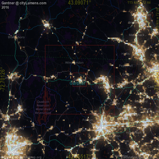
Analysis of Gardner night lights 2016
Square area 10x10 km:
 1.75%
1.75%90-99
3.02%80-89
1.75%70-79
2.38%60-69
3.97%50-59
2.22%40-49
2.7%30-39
3.97%20-29
4.44%10-19
16.67%0-9
57.14%Square area 50x50 km:
0.62%90-99
0.76%80-89
0.7%70-79
0.73%60-69
0.87%50-59
1.11%40-49
1.33%30-39
1.21%20-29
2.49%10-19
5.94%0-9
84.23%Clear (daylight) street map image can be seen on geolist.org.
Map coordinates:
43° 5' 26.6" North, 72° 42' 4.5" West
42° 34' 30.3" North, 71° 59' 53.3" West
42° 3' 18.6" North, 71° 17' 42" West
Some cities around Gardner sort by population:
• Leominster
20.3 km =12.6 mi,  105°
105°
• Fitchburg
16.1 km =10 mi,  86°
86°
• Athol
18.9 km =11.7 mi,  277°
277°
• Westminster
7.9 km =4.9 mi, 114°
• Templeton
6.1 km =3.8 mi,  249°
249°
• Rindge
19.6 km =12.2 mi,  357°
357°
• Ashburnham
10 km =6.2 mi,  47°
47°
• New Ipswich
22.6 km =14 mi,  31°
31°
4937557 (p: 20,333)
Sources (retrieved 2019-11-25):
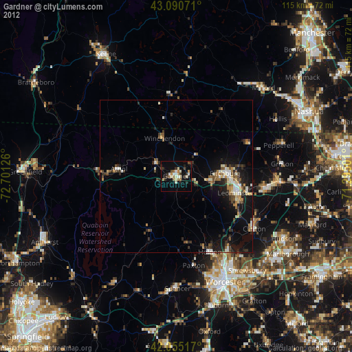
» Earth at Night: Flat Maps 2012, 2016