Westminster night lights from space
Night Light of Westminster (Massachusetts) from space (United States) Src. Average luminocity for 10x10km area is 13.3651% and for 50x50km: 10.0221%.
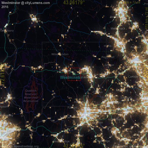
Analysis of Westminster night lights 2016
Square area 10x10 km:
 0%
0%90-99
0.79%80-89
1.75%70-79
1.27%60-69
1.75%50-59
2.54%40-49
3.02%30-39
2.7%20-29
3.17%10-19
10.48%0-9
72.54%Square area 50x50 km:
0.86%90-99
1.14%80-89
1.12%70-79
1.16%60-69
1.28%50-59
1.65%40-49
1.71%30-39
1.57%20-29
3.86%10-19
9.57%0-9
76.08%Clear (daylight) street map image can be seen on geolist.org.
Map coordinates:
43° 3' 42.4" North, 72° 36' 49.5" West
42° 32' 45.3" North, 71° 54' 38.3" West
42° 1' 32.7" North, 71° 12' 27" West
Some cities around Westminster sort by population:
• Leominster
12.6 km =7.8 mi,  100°
100°
• Fitchburg
9.8 km =6.1 mi,  64°
64°
• Gardner
7.9 km =4.9 mi,  294°
294°
• Holden
21.9 km =13.6 mi,  169°
169°
• Lancaster
21.9 km =13.6 mi,  117°
117°
• Sterling
17.2 km =10.7 mi,  134°
134°
• Templeton
12.9 km =8 mi,  274°
274°
• Ashburnham
10 km =6.2 mi,  1°
1°
4955247 (p: 7,028)
Sources (retrieved 2019-11-25):
» Earth at Night: Flat Maps 2012, 2016