Fraser night lights from space
Night Light of Fraser (Michigan) from space (United States) Src. Average luminocity for 10x10km area is 93.7413% and for 50x50km: 57.697%.
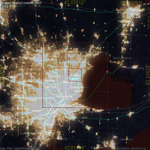
Analysis of Fraser night lights 2016
Square area 10x10 km:
 40.79%
90-99
33.02%80-89
12.86%70-79
12.54%60-69
0.79%50-59
0%40-49
0%30-39
0%20-29
0%10-19
0%0-9
0%Square area 50x50 km:
25.63%90-99
12.86%80-89
5.57%70-79
6.31%60-69
6.23%50-59
3.64%40-49
2.37%30-39
2.32%20-29
4.62%10-19
5.96%0-9
24.47%Clear (daylight) street map image can be seen on geolist.org.
Map coordinates:
43° 3' 18.4" North, 83° 39' 9" West
42° 32' 21.1" North, 82° 56' 57.7" West
42° 1' 8.3" North, 82° 14' 46.5" West
Some cities around Fraser sort by population:
• Warren
7.5 km =4.7 mi,  223°
223°
• Sterling Heights
8 km =5 mi,  304°
304°
• Clinton Township
5.8 km =3.6 mi,  24°
24°
• Saint Clair Shores
6.8 km =4.2 mi,  133°
133°
• Roseville
4.8 km =3 mi,  167°
167°
• Eastpointe
7.9 km =4.9 mi,  183°
183°
• Mount Clemens
8.7 km =5.4 mi,  42°
42°
• Center Line
8.8 km =5.5 mi,  226°
226°
4993369 (p: 14,636)
Sources (retrieved 2019-11-25):
» Earth at Night: Flat Maps 2012, 2016