Center Line night lights from space
Night Light of Center Line (Michigan) from space (United States) Src. Average luminocity for 10x10km area is 99.5397% and for 50x50km: 72.3454%.
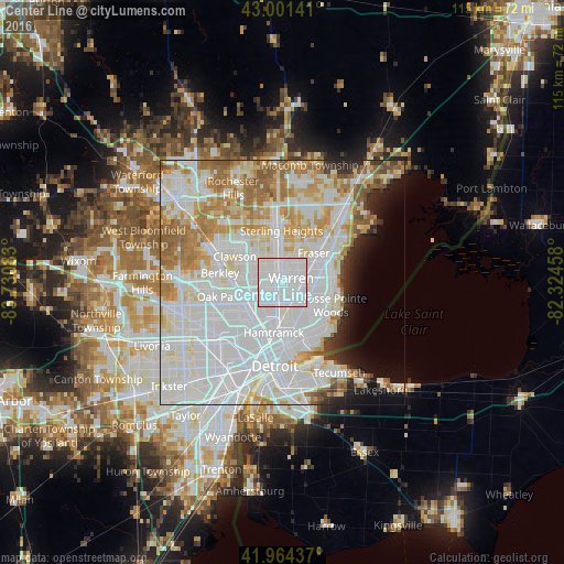
Analysis of Center Line night lights 2016
Square area 10x10 km:
 76.67%
90-99
23.33%80-89
0%70-79
0%60-69
0%50-59
0%40-49
0%30-39
0%20-29
0%10-19
0%0-9
0%Square area 50x50 km:
33.04%90-99
18.87%80-89
6.71%70-79
7.24%60-69
7.54%50-59
4.14%40-49
1.69%30-39
1.52%20-29
2.96%10-19
3.75%0-9
12.55%Clear (daylight) street map image can be seen on geolist.org.
Map coordinates:
43° 0' 5.1" North, 83° 43' 51" West
42° 29' 6.1" North, 83° 1' 39.7" West
41° 57' 51.7" North, 82° 19' 28.5" West
Some cities around Center Line sort by population:
• Warren
1.3 km =0.8 mi,  63°
63°
• Royal Oak
9.6 km =6 mi,  272°
272°
• Roseville
7.5 km =4.7 mi,  79°
79°
• Eastpointe
6.2 km =3.9 mi,  107°
107°
• Madison Heights
6.4 km =4 mi, 270°
• Ferndale
9.2 km =5.7 mi,  252°
252°
• Hazel Park
6.7 km =4.2 mi, 248°
• Fraser
8.8 km =5.5 mi,  46°
46°
4988400 (p: 8,320)
Sources (retrieved 2019-11-25):
» Earth at Night: Flat Maps 2012, 2016