Clinton Township night lights from space
Night Light of Clinton Township (Michigan) from space (United States) Src. Average luminocity for 10x10km area is 90.0045% and for 50x50km: 48.7803%.
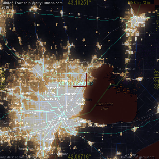
Analysis of Clinton Township night lights 2016
Square area 10x10 km:
 26.82%
90-99
32.42%80-89
17.58%70-79
20.3%60-69
2.73%50-59
0.15%40-49
0%30-39
0%20-29
0%10-19
0%0-9
0%Square area 50x50 km:
20.07%90-99
10.49%80-89
5.02%70-79
5.58%60-69
5.71%50-59
3.58%40-49
2.31%30-39
2.33%20-29
4.88%10-19
7.25%0-9
32.78%Clear (daylight) street map image can be seen on geolist.org.
Map coordinates:
43° 6' 9" North, 83° 37' 23" West
42° 35' 13.1" North, 82° 55' 11.7" West
42° 4' 1.8" North, 82° 13' 0.5" West
Some cities around Clinton Township sort by population:
• Warren
13.2 km =8.2 mi,  215°
215°
• Sterling Heights
9.1 km =5.7 mi,  265°
265°
• Shelby
13.1 km =8.1 mi,  315°
315°
• Saint Clair Shores
10.3 km =6.4 mi,  165°
165°
• Roseville
10.1 km =6.3 mi,  188°
188°
• Eastpointe
13.5 km =8.4 mi, 192°
• Mount Clemens
3.6 km =2.2 mi,  71°
71°
• Fraser
5.8 km =3.6 mi,  204°
204°
4989133 (p: 99,753)
Sources (retrieved 2019-11-25):
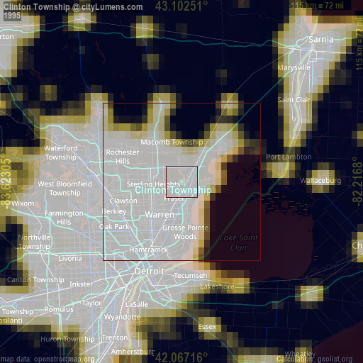
» NASA, Earths city lights 1995
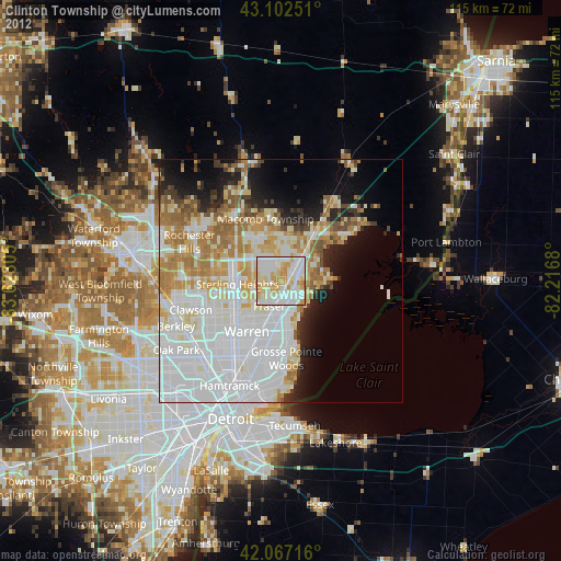
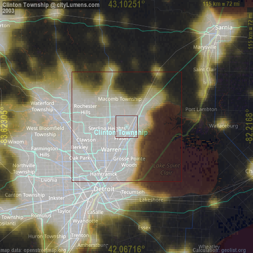
» NASA city lights 2003
» Earth at Night: Flat Maps 2012, 2016