Frankfort night lights from space
Night Light of Frankfort (Illinois) from space (United States) Src. Average luminocity for 10x10km area is 64.0595% and for 50x50km: 54.9185%.
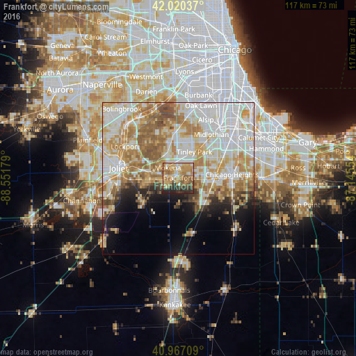
Analysis of Frankfort night lights 2016
Square area 10x10 km:
 4.25%
4.25%90-99
7.48%80-89
13.61%70-79
18.37%60-69
21.94%50-59
11.05%40-49
3.91%30-39
9.69%20-29
9.52%10-19
0.17%0-9
0%Square area 50x50 km:
15.37%90-99
12.97%80-89
8.19%70-79
8.64%60-69
8.99%50-59
6.35%40-49
2.69%30-39
2.32%20-29
3.38%10-19
6.26%0-9
24.86%Clear (daylight) street map image can be seen on geolist.org.
Map coordinates:
42° 1' 13.3" North, 88° 33' 6.4" West
41° 29' 45.1" North, 87° 50' 55.2" West
40° 58' 1.5" North, 87° 8' 43.9" West
Some cities around Frankfort sort by population:
• Tinley Park
10.1 km =6.3 mi,  31°
31°
• New Lenox
9.9 km =6.2 mi,  280°
280°
• Mokena
4.8 km =3 mi,  314°
314°
• Matteson
11.3 km =7 mi,  85°
85°
• Country Club Hills
13.4 km =8.3 mi,  53°
53°
• Richton Park
12.2 km =7.6 mi,  95°
95°
• Orland Hills
10 km =6.2 mi,  2°
2°
• Monee
12.3 km =7.6 mi,  133°
133°
4893037 (p: 18,653)
Sources (retrieved 2019-11-25):
» Earth at Night: Flat Maps 2012, 2016