New Lenox night lights from space
Night Light of New Lenox (Illinois) from space (United States) Src. Average luminocity for 10x10km area is 68.9082% and for 50x50km: 58.2375%.
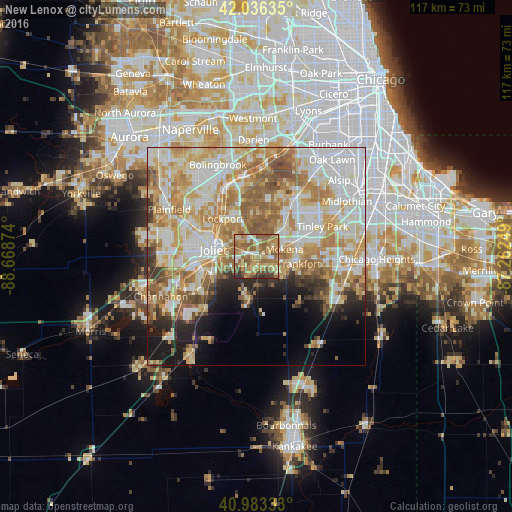
Analysis of New Lenox night lights 2016
Square area 10x10 km:
 6.29%
6.29%90-99
6.12%80-89
14.8%70-79
18.88%60-69
22.62%50-59
19.73%40-49
7.65%30-39
2.21%20-29
1.7%10-19
0%0-9
0%Square area 50x50 km:
13.58%90-99
13.42%80-89
10.01%70-79
10.33%60-69
10.36%50-59
7.33%40-49
3.25%30-39
2.84%20-29
3.83%10-19
6.79%0-9
18.26%Clear (daylight) street map image can be seen on geolist.org.
Map coordinates:
42° 2' 10.9" North, 88° 40' 7.5" West
41° 30' 43.1" North, 87° 57' 56.2" West
40° 58' 60" North, 87° 15' 45" West
Some cities around New Lenox sort by population:
• Joliet
9.9 km =6.2 mi,  278°
278°
• Lockport
11.5 km =7.1 mi,  318°
318°
• Homer Glen
10.1 km =6.3 mi,  13°
13°
• Crest Hill
12.1 km =7.5 mi,  293°
293°
• Mokena
6.6 km =4.1 mi,  76°
76°
• Frankfort
9.9 km =6.2 mi,  100°
100°
• Manhattan
10.1 km =6.3 mi,  189°
189°
• Orland Hills
13.1 km =8.1 mi,  51°
51°
4903535 (p: 25,800)
Sources (retrieved 2019-11-25):
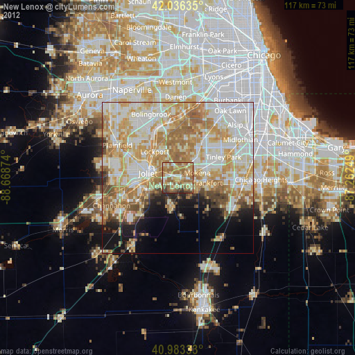
» Earth at Night: Flat Maps 2012, 2016