Forest Park night lights from space
Night Light of Forest Park (Georgia) from space (United States) Src. Average luminocity for 10x10km area is 97.8132% and for 50x50km: 81.3437%.
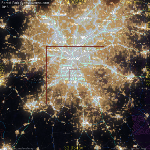
Analysis of Forest Park night lights 2016
Square area 10x10 km:
 50.92%
90-99
40.84%80-89
8.24%70-79
0%60-69
0%50-59
0%40-49
0%30-39
0%20-29
0%10-19
0%0-9
0%Square area 50x50 km:
22.88%90-99
20.63%80-89
14.53%70-79
15.72%60-69
12.31%50-59
6.63%40-49
4.54%30-39
2.5%20-29
0.25%10-19
0%0-9
0%Clear (daylight) street map image can be seen on geolist.org.
Map coordinates:
34° 12' 20" North, 85° 4' 20" West
33° 37' 19.4" North, 84° 22' 8.7" West
33° 2' 4.5" North, 83° 39' 57.5" West
Some cities around Forest Park sort by population:
• East Point
9.1 km =5.7 mi,  314°
314°
• Riverdale
6.9 km =4.3 mi,  216°
216°
• College Park
8.2 km =5.1 mi,  295°
295°
• Panthersville
13.1 km =8.1 mi,  43°
43°
• Gresham Park
10.4 km =6.5 mi,  29°
29°
• Morrow
5.1 km =3.2 mi,  147°
147°
• Hapeville
5.7 km =3.5 mi,  318°
318°
• Conley
4.7 km =2.9 mi,  57°
57°
4195701 (p: 19,383)
Sources (retrieved 2019-11-25):
» Earth at Night: Flat Maps 2012, 2016