Conley night lights from space
Night Light of Conley (Georgia) from space (United States) Src. Average luminocity for 10x10km area is 92.6795% and for 50x50km: 82.2987%.
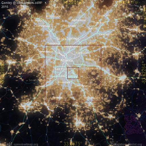
Analysis of Conley night lights 2016
Square area 10x10 km:
 29.85%
90-99
35.71%80-89
25.82%70-79
8.61%60-69
0%50-59
0%40-49
0%30-39
0%20-29
0%10-19
0%0-9
0%Square area 50x50 km:
23.47%90-99
21.36%80-89
15.36%70-79
16.03%60-69
11.96%50-59
5.41%40-49
3.99%30-39
2.09%20-29
0.33%10-19
0%0-9
0%Clear (daylight) street map image can be seen on geolist.org.
Map coordinates:
34° 13' 41.4" North, 85° 1' 44" West
33° 38' 41.4" North, 84° 19' 32.7" West
33° 3' 27" North, 83° 37' 21.5" West
Some cities around Conley sort by population:
• East Point
11.2 km =7 mi,  290°
290°
• Candler-McAfee
10.4 km =6.5 mi,  28°
28°
• Forest Park
4.7 km =2.9 mi,  237°
237°
• Riverdale
11.4 km =7.1 mi,  225°
225°
• Panthersville
8.6 km =5.3 mi,  35°
35°
• Gresham Park
6.6 km =4.1 mi,  9°
9°
• Morrow
7 km =4.3 mi,  190°
190°
• Hapeville
8 km =5 mi,  282°
282°
4189157 (p: 6,228)
Sources (retrieved 2019-11-25):
» Earth at Night: Flat Maps 2012, 2016