Gresham Park night lights from space
Night Light of Gresham Park (Georgia) from space (United States) Src. Average luminocity for 10x10km area is 93.9634% and for 50x50km: 85.0315%.
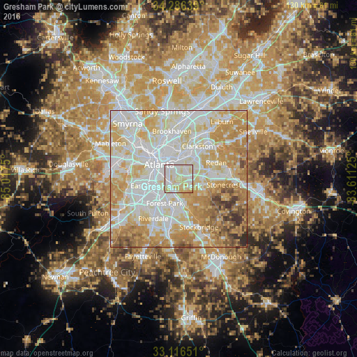
Analysis of Gresham Park night lights 2016
Square area 10x10 km:
 34.8%
34.8%90-99
37.18%80-89
24.73%70-79
3.3%60-69
0%50-59
0%40-49
0%30-39
0%20-29
0%10-19
0%0-9
0%Square area 50x50 km:
26.95%90-99
23.78%80-89
15.94%70-79
15.91%60-69
9.38%50-59
3.37%40-49
2.55%30-39
1.59%20-29
0.52%10-19
0%0-9
0%Clear (daylight) street map image can be seen on geolist.org.
Map coordinates:
34° 17' 11" North, 85° 1' 3" West
33° 42' 12.4" North, 84° 18' 51.7" West
33° 6' 59.4" North, 83° 36' 40.5" West
Some cities around Gresham Park sort by population:
• Atlanta
8.5 km =5.3 mi,  306°
306°
• Candler-McAfee
4.7 km =2.9 mi,  56°
56°
• Decatur
8.1 km =5 mi,  11°
11°
• North Decatur
9.7 km =6 mi,  4°
4°
• Belvedere Park
7.2 km =4.5 mi,  37°
37°
• Druid Hills
8.8 km =5.5 mi,  346°
346°
• Panthersville
4 km =2.5 mi,  83°
83°
• Conley
6.6 km =4.1 mi,  189°
189°
4198298 (p: 7,432)
Sources (retrieved 2019-11-25):
» Earth at Night: Flat Maps 2012, 2016