Lewisville night lights from space
Night Light of Lewisville (Texas) from space (United States) Src. Average luminocity for 10x10km area is 80.1923% and for 50x50km: 77.8795%.
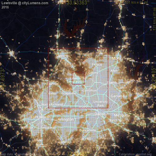
Analysis of Lewisville night lights 2016
Square area 10x10 km:
 21.98%
90-99
24.73%80-89
14.84%70-79
7.51%60-69
12.45%50-59
6.96%40-49
3.48%30-39
8.06%20-29
0%10-19
0%0-9
0%Square area 50x50 km:
27.77%90-99
22.95%80-89
9.94%70-79
7.73%60-69
7.42%50-59
6.67%40-49
4.64%30-39
4.4%20-29
4.23%10-19
3.33%0-9
0.92%Clear (daylight) street map image can be seen on geolist.org.
Map coordinates:
33° 38' 1.1" North, 97° 41' 50.3" West
33° 2' 46.4" North, 96° 59' 39" West
32° 27' 17.6" North, 96° 17' 27.8" West
Some cities around Lewisville sort by population:
• Flower Mound
10.2 km =6.3 mi,  249°
249°
• The Colony
11.1 km =6.9 mi,  64°
64°
• Coppell
10.4 km =6.5 mi,  190°
190°
• Little Elm
14 km =8.7 mi,  22°
22°
• Corinth
13.7 km =8.5 mi,  331°
331°
• Highland Village
7 km =4.3 mi,  315°
315°
• Lake Dallas
8.6 km =5.3 mi,  340°
340°
• Lantana
13.1 km =8.1 mi,  292°
292°
4706057 (p: 104,039)
Sources (retrieved 2019-11-25):
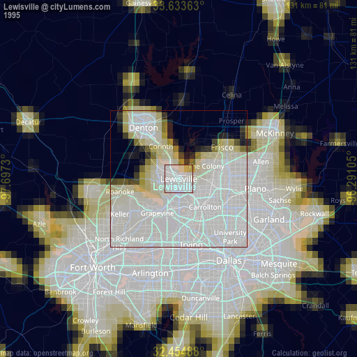
» NASA, Earths city lights 1995
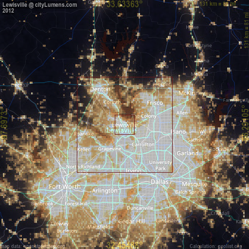
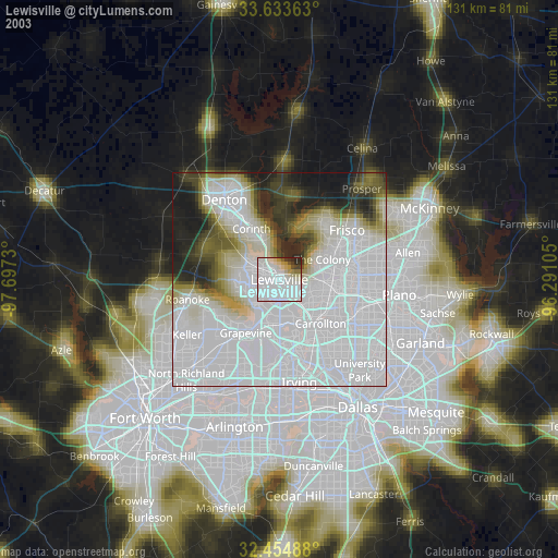
» NASA city lights 2003
» Earth at Night: Flat Maps 2012, 2016