Elon night lights from space
Night Light of Elon (North Carolina) from space (United States) Src. Average luminocity for 10x10km area is 66.0604% and for 50x50km: 21.7616%.
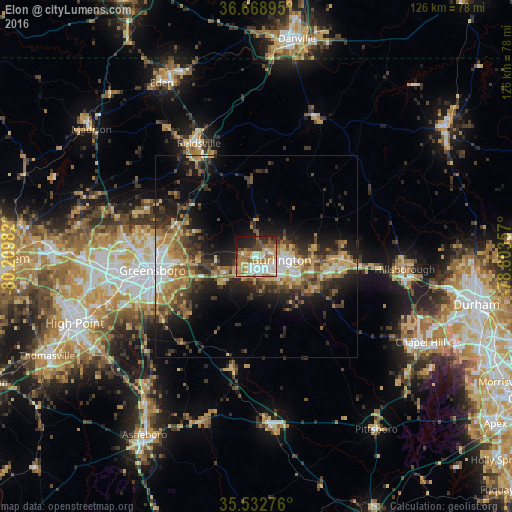
Analysis of Elon night lights 2016
Square area 10x10 km:
 13.19%
90-99
17.22%80-89
7.51%70-79
11.36%60-69
13%50-59
8.42%40-49
8.42%30-39
3.66%20-29
9.71%10-19
7.14%0-9
0.37%Square area 50x50 km:
2.4%90-99
2.51%80-89
3.53%70-79
3.35%60-69
3.91%50-59
3.03%40-49
3.7%30-39
5.03%20-29
6.05%10-19
10.94%0-9
55.56%Clear (daylight) street map image can be seen on geolist.org.
Map coordinates:
36° 40' 8.2" North, 80° 12' 35.4" West
36° 6' 10.5" North, 79° 30' 24.1" West
35° 31' 57.9" North, 78° 48' 12.9" West
Some cities around Elon sort by population:
• Greensboro
25.9 km =16.1 mi,  262°
262°
• Burlington
6.2 km =3.9 mi,  97°
97°
• Graham
10.3 km =6.4 mi,  111°
111°
• Reidsville
31.4 km =19.5 mi,  333°
333°
• Mebane
21.6 km =13.4 mi,  92°
92°
• Summerfield
37.6 km =23.4 mi,  288°
288°
• Gibsonville
3.2 km =2 mi,  275°
275°
• Hillsborough
36.7 km =22.8 mi, 94°
4465285 (p: 10,024)
Sources (retrieved 2019-11-25):
» Earth at Night: Flat Maps 2012, 2016