Burlington night lights from space
Night Light of Burlington (North Carolina) from space (United States) Src. Average luminocity for 10x10km area is 80.1227% and for 50x50km: 17.1115%.
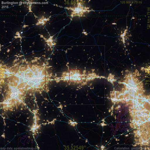
Analysis of Burlington night lights 2016
Square area 10x10 km:
 20.33%
90-99
26.37%80-89
14.65%70-79
10.07%60-69
10.44%50-59
5.86%40-49
4.95%30-39
4.76%20-29
2.56%10-19
0%0-9
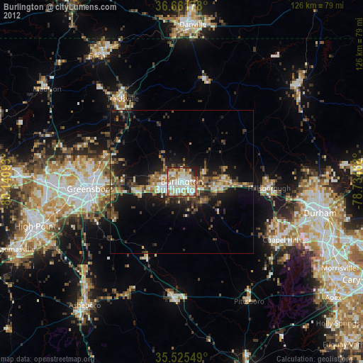
0%Square area 50x50 km:
1.41%90-99
1.66%80-89
2.92%70-79
2.23%60-69
2.99%50-59
2.51%40-49
3.24%30-39
4.62%20-29
5.38%10-19
10.41%0-9
62.62%Clear (daylight) street map image can be seen on geolist.org.
Map coordinates:
36° 39' 42.4" North, 80° 8' 27.3" West
36° 5' 44.5" North, 79° 26' 16.1" West
35° 31' 31.8" North, 78° 44' 4.8" West
Some cities around Burlington sort by population:
• Greensboro
31.9 km =19.8 mi,  265°
265°
• Carrboro
38.6 km =24 mi,  122°
122°
• Graham
4.5 km =2.8 mi,  131°
131°
• Reidsville
35.3 km =21.9 mi,  324°
324°
• Mebane
15.3 km =9.5 mi,  89°
89°
• Elon
6.2 km =3.9 mi,  277°
277°
• Gibsonville
9.4 km =5.8 mi, 276°
• Hillsborough
30.5 km =19 mi, 94°
4458228 (p: 52,472)
Sources (retrieved 2019-11-25):
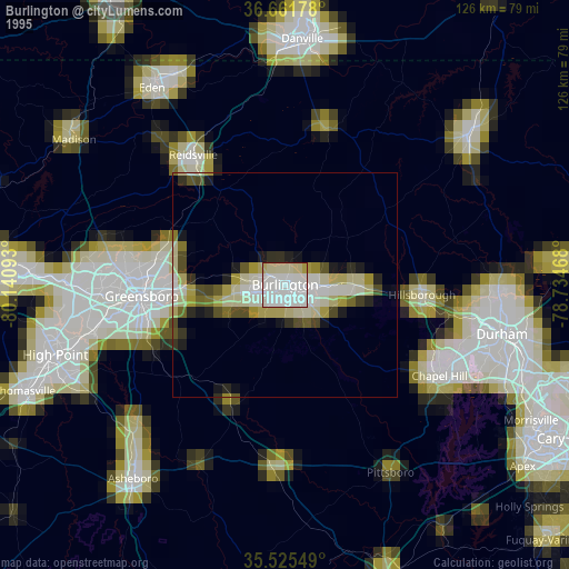
» NASA, Earths city lights 1995
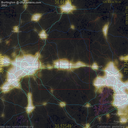
» NASA city lights 2003
» Earth at Night: Flat Maps 2012, 2016