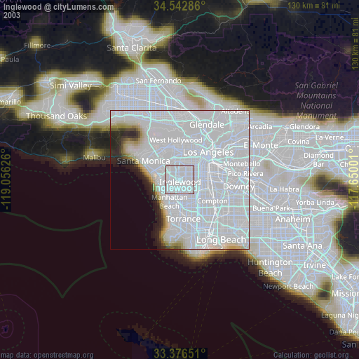
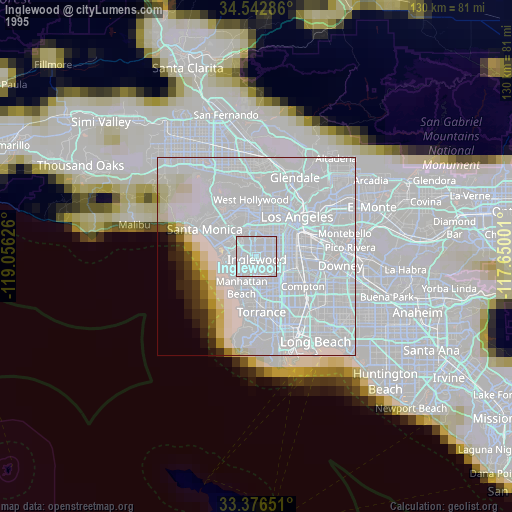
Inglewood night lights from space
Night Light of Inglewood (California) from space (United States) Src. Average luminocity for 10x10km area is 99.5577% and for 50x50km: 70.4205%.

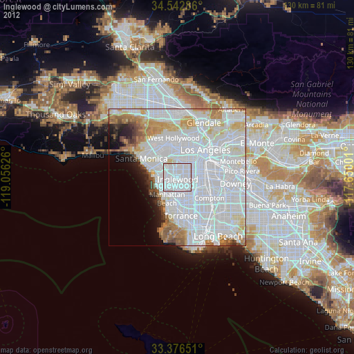
Analysis of Inglewood night lights 2016
Square area 10x10 km:
 81.12%
90-99
18.53%80-89
0.35%70-79
0%60-69
0%50-59
0%40-49
0%30-39
0%20-29
0%10-19
0%0-9
0%Square area 50x50 km:
41.35%90-99
15.7%80-89
4.29%70-79
4.28%60-69
4.42%50-59
2.61%40-49
1.75%30-39
1.83%20-29
2.54%10-19
3.17%0-9
18.07%Clear (daylight) street map image can be seen on geolist.org.
Map coordinates:
34° 32' 34.3" North, 119° 3' 22.5" West
33° 57' 42" North, 118° 21' 11.3" West
33° 22' 35.4" North, 117° 39' 0" West
Some cities around Inglewood sort by population:
• Hawthorne
5 km =3.1 mi,  179°
179°
• Westmont
5.2 km =3.2 mi,  115°
115°
• Lennox
2.6 km =1.6 mi, 178°
• El Segundo
7.5 km =4.7 mi,  231°
231°
• View Park-Windsor Hills
3.8 km =2.4 mi,  6°
6°
• Del Aire
5.3 km =3.3 mi,  196°
196°
• West Athens
6.3 km =3.9 mi,  132°
132°
• Ladera Heights
4.2 km =2.6 mi,  330°
330°
5359488 (p: 111,666)
Sources (retrieved 2019-11-25):
» NASA, Earths city lights 1995
» NASA city lights 2003
» Earth at Night: Flat Maps 2012, 2016