El Campo night lights from space
Night Light of El Campo (Texas) from space (United States) Src. Average luminocity for 10x10km area is 41.4167% and for 50x50km: 4.2396%.
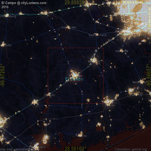
Analysis of El Campo night lights 2016
Square area 10x10 km:
 3.97%
3.97%90-99
4.76%80-89
8.73%70-79
7.54%60-69
10.32%50-59
3.57%40-49
6.94%30-39
5.36%20-29
5.95%10-19
30.95%0-9
11.9%Square area 50x50 km:
0.27%90-99
0.27%80-89
0.81%70-79
0.53%60-69
0.71%50-59
0.44%40-49
0.68%30-39
0.98%20-29
0.7%10-19
3.51%0-9
91.09%Clear (daylight) street map image can be seen on geolist.org.
Map coordinates:
29° 48' 30.9" North, 96° 58' 22.2" West
29° 11' 47.9" North, 96° 16' 10.9" West
28° 34' 51.7" North, 95° 33' 59.7" West
Some cities around El Campo sort by population:
• Rosenberg
60 km =37.3 mi,  48°
48°
• Bay City
37.6 km =23.4 mi,  129°
129°
• Richmond
65.3 km =40.6 mi, 48°
• Greatwood
69.9 km =43.4 mi,  55°
55°
• Wharton
20.6 km =12.8 mi, 51°
• Sealy
65.9 km =40.9 mi,  9°
9°
• Fulshear
65.5 km =40.7 mi,  33°
33°
• Edna
43.9 km =27.3 mi,  236°
236°
4688506 (p: 11,604)
Sources (retrieved 2019-11-25):
» Earth at Night: Flat Maps 2012, 2016