Rosenberg night lights from space
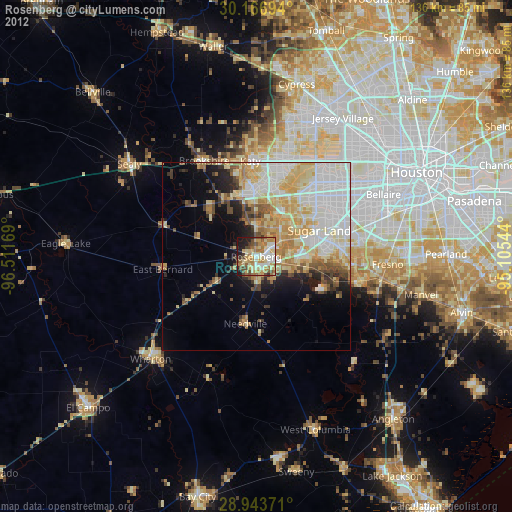
Night Light of Rosenberg (Texas) from space (United States) Src. Average luminocity for 10x10km area is 63.1098% and for 50x50km: 34.6921%.
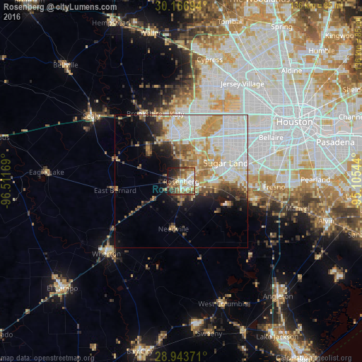
Analysis of Rosenberg night lights 2016
Square area 10x10 km:
 12.12%
90-99
12.69%80-89
11.17%70-79
7.77%60-69
10.04%50-59
10.8%40-49
12.5%30-39
6.25%20-29
8.33%10-19
8.33%0-9
0%Square area 50x50 km:
10.36%90-99
8.4%80-89
4.55%70-79
4.81%60-69
3.86%50-59
3.13%40-49
2.69%30-39
2.35%20-29
3.63%10-19
6.27%0-9
49.94%Clear (daylight) street map image can be seen on geolist.org.
Map coordinates:
30° 10' 1" North, 96° 30' 42.1" West
29° 33' 25.8" North, 95° 48' 30.8" West
28° 56' 37.4" North, 95° 6' 19.6" West
Some cities around Rosenberg sort by population:
• Sugar Land
18.2 km =11.3 mi,  67°
67°
• Mission Bend
20.6 km =12.8 mi,  42°
42°
• Pecan Grove
10.7 km =6.6 mi, 44°
• New Territory
13 km =8.1 mi, 71°
• Four Corners
19.1 km =11.9 mi,  49°
49°
• Richmond
5.4 km =3.4 mi,  58°
58°
• Greatwood
12.8 km =8 mi,  91°
91°
• Fulshear
17.2 km =10.7 mi,  329°
329°
4723914 (p: 35,510)
Sources (retrieved 2019-11-25):
» Earth at Night: Flat Maps 2012, 2016