Fulshear night lights from space
Night Light of Fulshear (Texas) from space (United States) Src. Average luminocity for 10x10km area is 38.7044% and for 50x50km: 36.0369%.
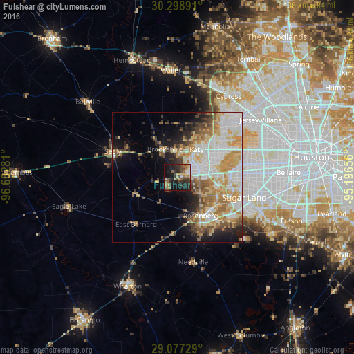
Analysis of Fulshear night lights 2016
Square area 10x10 km:
 2.18%
2.18%90-99
3.57%80-89
7.54%70-79
3.57%60-69
7.14%50-59
7.14%40-49
6.15%30-39
10.91%20-29
19.64%10-19
27.98%0-9
4.17%Square area 50x50 km:
7.97%90-99
8.15%80-89
5.57%70-79
6.12%60-69
5.08%50-59
3.48%40-49
3.36%30-39
3.44%20-29
4.33%10-19
7.98%0-9
44.52%Clear (daylight) street map image can be seen on geolist.org.
Map coordinates:
30° 17' 56.1" North, 96° 36' 10.1" West
29° 41' 23.9" North, 95° 53' 58.8" West
29° 4' 38.2" North, 95° 11' 47.6" West
Some cities around Fulshear sort by population:
• Mission Bend
22.7 km =14.1 mi,  88°
88°
• Rosenberg
17.2 km =10.7 mi,  149°
149°
• Cinco Ranch
14.7 km =9.1 mi,  68°
68°
• Katy
12.9 km =8 mi,  34°
34°
• Pecan Grove
17.7 km =11 mi,  113°
113°
• Four Corners
23.5 km =14.6 mi,  95°
95°
• Richmond
18 km =11.2 mi,  131°
131°
• Brookshire
11.8 km =7.3 mi,  335°
335°
4692658 (p: 5,886)
Sources (retrieved 2019-11-25):
» Earth at Night: Flat Maps 2012, 2016