Edgewood night lights from space
Night Light of Edgewood (Maryland) from space (United States) Src. Average luminocity for 10x10km area is 47.6241% and for 50x50km: 29.9078%.
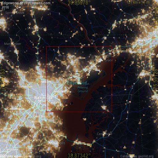
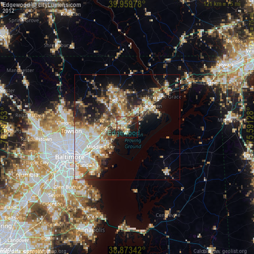
Analysis of Edgewood night lights 2016
Square area 10x10 km:
 6.29%
6.29%90-99
6.8%80-89
8.67%70-79
5.95%60-69
5.27%50-59
11.22%40-49
10.03%30-39
4.42%20-29
19.22%10-19
15.82%0-9
6.29%Square area 50x50 km:
6.7%90-99
4.68%80-89
3.5%70-79
3.75%60-69
3.93%50-59
4.3%40-49
4.69%30-39
5.46%20-29
7.37%10-19
10.87%0-9
44.76%Clear (daylight) street map image can be seen on geolist.org.
Map coordinates:
39° 57' 35.2" North, 76° 59' 51.1" West
39° 25' 7.4" North, 76° 17' 39.8" West
38° 52' 24.3" North, 75° 35' 28.6" West
Some cities around Edgewood sort by population:
• South Bel Air
13.3 km =8.3 mi,  343°
343°
• Bel Air South
9.8 km =6.1 mi,  347°
347°
• North Bel Air
14.4 km =8.9 mi, 338°
• Joppatowne
6.8 km =4.2 mi,  309°
309°
• Bel Air
13.8 km =8.6 mi, 340°
• White Marsh
12.5 km =7.8 mi,  251°
251°
• Bowleys Quarters
12.4 km =7.7 mi,  221°
221°
• Riverside
7.6 km =4.7 mi,  36°
36°
4354087 (p: 25,562)
Sources (retrieved 2019-11-25):
» Earth at Night: Flat Maps 2012, 2016