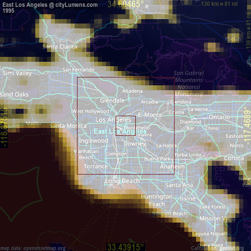
East Los Angeles night lights from space
Night Light of East Los Angeles (California) from space (United States) Src. Average luminocity for 10x10km area is 99.465% and for 50x50km: 86.6967%.

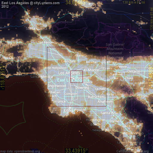
Analysis of East Los Angeles night lights 2016
Square area 10x10 km:
 83.92%
90-99
15.56%80-89
0.52%70-79
0%60-69
0%50-59
0%40-49
0%30-39
0%20-29
0%10-19
0%0-9
0%Square area 50x50 km:
50.18%90-99
21.82%80-89
5.86%70-79
6.18%60-69
4.42%50-59
1.96%40-49
1.14%30-39
1.15%20-29
1.73%10-19
2.4%0-9
3.17%Clear (daylight) street map image can be seen on geolist.org.
Map coordinates:
34° 36' 16.7" North, 118° 52' 30.5" West
34° 1' 26" North, 118° 10' 19.3" West
33° 26' 20.9" North, 117° 28' 8" West
Some cities around East Los Angeles sort by population:
• Boyle Heights
3.3 km =2.1 mi,  289°
289°
• Montebello
6.4 km =4 mi,  104°
104°
• Monterey Park
6.2 km =3.9 mi,  46°
46°
• Huntington Park
6.8 km =4.2 mi,  226°
226°
• Bell Gardens
6.8 km =4.2 mi,  163°
163°
• Bell
5.3 km =3.3 mi,  195°
195°
• Maywood
4.3 km =2.7 mi, 196°
• Commerce
2.8 km =1.7 mi, 156°
5344994 (p: 126,496)
Sources (retrieved 2019-11-25):
» NASA, Earths city lights 1995
» NASA city lights 2003
» Earth at Night: Flat Maps 2012, 2016