Grandville night lights from space
Night Light of Grandville (Michigan) from space (United States) Src. Average luminocity for 10x10km area is 61.2905% and for 50x50km: 25.8832%.
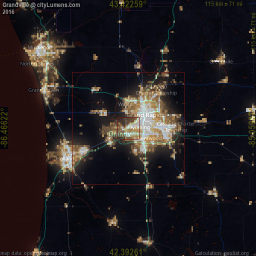
Analysis of Grandville night lights 2016
Square area 10x10 km:
 9.52%
9.52%90-99
11.11%80-89
7.62%70-79
8.73%60-69
13.81%50-59
10.79%40-49
14.29%30-39
11.11%20-29
10.16%10-19
2.86%0-9
0%Square area 50x50 km:
4.43%90-99
4.22%80-89
2.92%70-79
3.08%60-69
4.63%50-59
4.21%40-49
4.74%30-39
3.4%20-29
5.39%10-19
11.68%0-9
51.3%Clear (daylight) street map image can be seen on geolist.org.
Map coordinates:
43° 25' 21.3" North, 86° 27' 58.4" West
42° 54' 35.1" North, 85° 45' 47.1" West
42° 23' 33.4" North, 85° 3' 35.9" West
Some cities around Grandville sort by population:
• Wyoming
4.7 km =2.9 mi,  85°
85°
• Kentwood
10.6 km =6.6 mi,  114°
114°
• Walker
10.2 km =6.3 mi,  357°
357°
• Jenison
2.4 km =1.5 mi,  263°
263°
• Cutlerville
11.2 km =7 mi,  133°
133°
• East Grand Rapids
12.9 km =8 mi,  74°
74°
• Hudsonville
9.4 km =5.8 mi,  242°
242°
• Byron Center
11.3 km =7 mi,  163°
163°
4994391 (p: 15,953)
Sources (retrieved 2019-11-25):
» Earth at Night: Flat Maps 2012, 2016