Duvall night lights from space
Night Light of Duvall (Washington) from space (United States) Src. Average luminocity for 10x10km area is 8.2188% and for 50x50km: 28.352%.
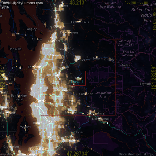
Analysis of Duvall night lights 2016
Square area 10x10 km:
 0.45%
0.45%90-99
0.74%80-89
0.6%70-79
0%60-69
0.45%50-59
2.23%40-49
2.68%30-39
2.53%20-29
1.19%10-19
5.36%0-9
83.78%Square area 50x50 km:
6.19%90-99
6%80-89
2.41%70-79
4.21%60-69
5.57%50-59
3.77%40-49
4.26%30-39
4.25%20-29
3.64%10-19
4.71%0-9
54.99%Clear (daylight) street map image can be seen on geolist.org.
Map coordinates:
48° 12' 46.8" North, 122° 41' 19.7" West
47° 44' 32.4" North, 121° 59' 8.4" West
47° 16' 2.4" North, 121° 16' 57.2" West
Some cities around Duvall sort by population:
• Redmond
12.7 km =7.9 mi,  233°
233°
• Sammamish
13.2 km =8.2 mi,  212°
212°
• Cottage Lake
6.9 km =4.3 mi,  271°
271°
• Union Hill-Novelty Hill
7.7 km =4.8 mi,  204°
204°
• Monroe
12.6 km =7.8 mi,  4°
4°
• Kingsgate
14.6 km =9.1 mi,  263°
263°
• Woodinville
13.4 km =8.3 mi,  275°
275°
• Maltby
11.8 km =7.3 mi,  306°
306°
5792990 (p: 7,674)
Sources (retrieved 2019-11-25):
» Earth at Night: Flat Maps 2012, 2016