Dunn Loring night lights from space
Night Light of Dunn Loring (Virginia) from space (United States) Src. Average luminocity for 10x10km area is 89.4439% and for 50x50km: 75.0487%.
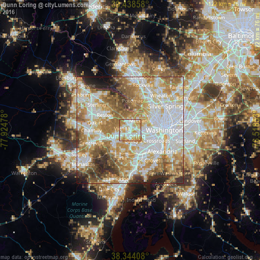
Analysis of Dunn Loring night lights 2016
Square area 10x10 km:
 29.76%
90-99
25.51%80-89
17.01%70-79
23.98%60-69
3.74%50-59
0%40-49
0%30-39
0%20-29
0%10-19
0%0-9
0%Square area 50x50 km:
21.93%90-99
17.7%80-89
10.25%70-79
13.19%60-69
12.37%50-59
8.14%40-49
4.62%30-39
4.23%20-29
4.87%10-19
2.19%0-9
0.51%Clear (daylight) street map image can be seen on geolist.org.
Map coordinates:
39° 26' 18.9" North, 77° 55' 29.2" West
38° 53' 36.4" North, 77° 13' 17.9" West
38° 20' 38.7" North, 76° 31' 6.7" West
Some cities around Dunn Loring sort by population:
• West Falls Church
4.3 km =2.7 mi,  137°
137°
• Tysons Corner
2.9 km =1.8 mi,  343°
343°
• Idylwood
0.9 km =0.6 mi,  77°
77°
• Vienna
3.9 km =2.4 mi,  282°
282°
• Merrifield
2.2 km =1.4 mi,  192°
192°
• Falls Church
4.5 km =2.8 mi,  105°
105°
• Woodburn
5.3 km =3.3 mi, 193°
• Pimmit Hills
2.8 km =1.7 mi,  39°
39°
4756736 (p: 8,803)
Sources (retrieved 2019-11-25):
» Earth at Night: Flat Maps 2012, 2016