Falls Church night lights from space
Night Light of Falls Church (Virginia) from space (United States) Src. Average luminocity for 10x10km area is 91.4252% and for 50x50km: 76.104%.
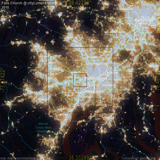
Analysis of Falls Church night lights 2016
Square area 10x10 km:
 33.67%
90-99
27.38%80-89
19.9%70-79
19.05%60-69
0%50-59
0%40-49
0%30-39
0%20-29
0%10-19
0%0-9
0%Square area 50x50 km:
23.55%90-99
18.18%80-89
10.57%70-79
13.02%60-69
11.11%50-59
7.4%40-49
4.56%30-39
4.73%20-29
4.58%10-19
2.05%0-9
0.23%Clear (daylight) street map image can be seen on geolist.org.
Map coordinates:
39° 25' 39.2" North, 77° 52' 27.2" West
38° 52' 56.4" North, 77° 10' 15.9" West
38° 19' 58.4" North, 76° 28' 4.7" West
Some cities around Falls Church sort by population:
• West Falls Church
2.4 km =1.5 mi,  216°
216°
• Baileys Crossroads
5 km =3.1 mi,  134°
134°
• Idylwood
3.8 km =2.4 mi,  292°
292°
• Merrifield
4.9 km =3 mi,  259°
259°
• Lake Barcroft
4.1 km =2.5 mi,  160°
160°
• Seven Corners
1.8 km =1.1 mi, 129°
• Dunn Loring
4.5 km =2.8 mi, 285°
• Pimmit Hills
4.3 km =2.7 mi,  322°
322°
4758390 (p: 13,892)
Sources (retrieved 2019-11-25):
» Earth at Night: Flat Maps 2012, 2016