Merrifield night lights from space
Night Light of Merrifield (Virginia) from space (United States) Src. Average luminocity for 10x10km area is 88.7432% and for 50x50km: 74.6113%.
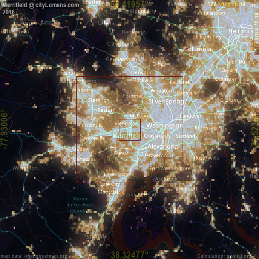
Analysis of Merrifield night lights 2016
Square area 10x10 km:
 27.72%
90-99
23.81%80-89
17.52%70-79
28.23%60-69
2.72%50-59
0%40-49
0%30-39
0%20-29
0%10-19
0%0-9
0%Square area 50x50 km:
21.75%90-99
17.46%80-89
10.32%70-79
13.04%60-69
12.16%50-59
7.96%40-49
4.71%30-39
4.59%20-29
5.06%10-19
2.63%0-9
0.33%Clear (daylight) street map image can be seen on geolist.org.
Map coordinates:
39° 25' 10.5" North, 77° 55' 48.2" West
38° 52' 27.4" North, 77° 13' 36.9" West
38° 19' 29.2" North, 76° 31' 25.7" West
Some cities around Merrifield sort by population:
• West Falls Church
3.5 km =2.2 mi,  107°
107°
• Idylwood
2.7 km =1.7 mi,  29°
29°
• Vienna
4.5 km =2.8 mi,  312°
312°
• Falls Church
4.9 km =3 mi,  79°
79°
• Dunn Loring
2.2 km =1.4 mi,  12°
12°
• Woodburn
3.1 km =1.9 mi,  194°
194°
• Mantua
3.6 km =2.2 mi,  230°
230°
• Pimmit Hills
4.9 km =3 mi, 27°
4772735 (p: 15,212)
Sources (retrieved 2019-11-25):
» Earth at Night: Flat Maps 2012, 2016