Duncanville night lights from space
Night Light of Duncanville (Texas) from space (United States) Src. Average luminocity for 10x10km area is 91.3601% and for 50x50km: 76.2423%.
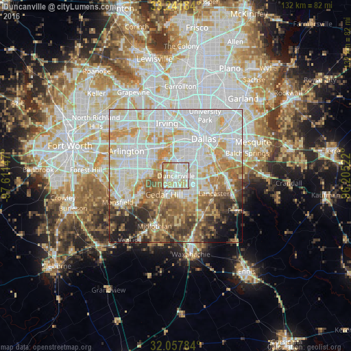
Analysis of Duncanville night lights 2016
Square area 10x10 km:
 29.02%
90-99
34.62%80-89
20.45%70-79
13.99%60-69
1.92%50-59
0%40-49
0%30-39
0%20-29
0%10-19
0%0-9
0%Square area 50x50 km:
24.96%90-99
21.94%80-89
10.34%70-79
9.96%60-69
7.25%50-59
6.89%40-49
5.3%30-39
4.25%20-29
3.75%10-19
3.45%0-9
1.91%Clear (daylight) street map image can be seen on geolist.org.
Map coordinates:
33° 14' 30.6" North, 97° 36' 41.3" West
32° 39' 6.5" North, 96° 54' 30" West
32° 3' 28.2" North, 96° 12' 18.8" West
Some cities around Duncanville sort by population:
• Dallas
17.4 km =10.8 mi,  33°
33°
• Grand Prairie
13.4 km =8.3 mi,  321°
321°
• DeSoto
8.4 km =5.2 mi,  145°
145°
• Cedar Hill
8.3 km =5.2 mi,  212°
212°
• Lancaster
15.7 km =9.8 mi,  114°
114°
• Glenn Heights
12.4 km =7.7 mi,  157°
157°
• Red Oak
17.8 km =11.1 mi, 146°
• Hutchins
18.3 km =11.4 mi,  90°
90°
4687331 (p: 39,826)
Sources (retrieved 2019-11-25):
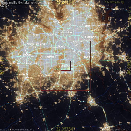
» Earth at Night: Flat Maps 2012, 2016