Delphos night lights from space
Night Light of Delphos (Ohio) from space (United States) Src. Average luminocity for 10x10km area is 14.8878% and for 50x50km: 8.1337%.
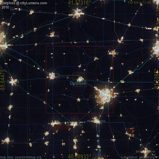
Analysis of Delphos night lights 2016
Square area 10x10 km:
 1.02%
1.02%90-99
1.02%80-89
3.4%70-79
3.23%60-69
2.21%50-59
1.36%40-49
1.36%30-39
1.87%20-29
2.21%10-19
1.36%0-9
80.95%Square area 50x50 km:
1.08%90-99
1.53%80-89
1.15%70-79
1.11%60-69
0.94%50-59
0.78%40-49
1.34%30-39
1.05%20-29
1.97%10-19
3.78%0-9
85.28%Clear (daylight) street map image can be seen on geolist.org.
Map coordinates:
41° 22' 23.4" North, 85° 2' 41.1" West
40° 50' 36.2" North, 84° 20' 29.8" West
40° 18' 33.6" North, 83° 38' 18.6" West
Some cities around Delphos sort by population:
• Lima
22.8 km =14.2 mi,  119°
119°
• Defiance
49.1 km =30.5 mi,  358°
358°
• Van Wert
20.6 km =12.8 mi,  278°
278°
• Celina
38 km =23.6 mi,  210°
210°
• Wapakoneta
33.1 km =20.6 mi,  157°
157°
• Decatur
49.4 km =30.7 mi,  268°
268°
• Saint Marys
33.7 km =20.9 mi,  186°
186°
• Ada
44.4 km =27.6 mi,  100°
100°
5151941 (p: 7,023)
Sources (retrieved 2019-11-25):
» Earth at Night: Flat Maps 2012, 2016