Defiance night lights from space
Night Light of Defiance (Ohio) from space (United States) Src. Average luminocity for 10x10km area is 34.5812% and for 50x50km: 4.3165%.
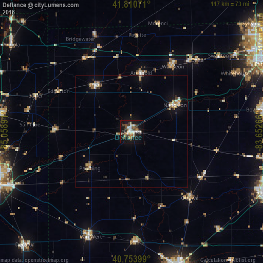
Analysis of Defiance night lights 2016
Square area 10x10 km:
 5.36%
5.36%90-99
8.12%80-89
1.62%70-79
5.03%60-69
1.95%50-59
4.22%40-49
7.31%30-39
6.98%20-29
2.92%10-19
38.64%0-9
17.86%Square area 50x50 km:
0.46%90-99
0.64%80-89
0.5%70-79
0.42%60-69
0.53%50-59
0.57%40-49
0.7%30-39
0.5%20-29
0.8%10-19
2.89%0-9
92%Clear (daylight) street map image can be seen on geolist.org.
Map coordinates:
41° 48' 38.6" North, 85° 3' 32.1" West
41° 17' 4.2" North, 84° 21' 20.8" West
40° 45' 14.4" North, 83° 39' 9.6" West
Some cities around Defiance sort by population:
• Bowling Green
59.7 km =37.1 mi,  80°
80°
• Auburn
59.4 km =36.9 mi,  278°
278°
• Van Wert
50 km =31.1 mi,  202°
202°
• Napoleon
22.7 km =14.1 mi,  58°
58°
• Bryan
26.8 km =16.7 mi,  322°
322°
• Wauseon
34.4 km =21.4 mi,  31°
31°
• Delphos
49.1 km =30.5 mi,  178°
178°
• Waterville
58.4 km =36.3 mi,  65°
65°
5151861 (p: 16,776)
Sources (retrieved 2019-11-25):
» Earth at Night: Flat Maps 2012, 2016