Dearborn night lights from space
Night Light of Dearborn (Michigan) from space (United States) Src. Average luminocity for 10x10km area is 99.7348% and for 50x50km: 76.4895%.
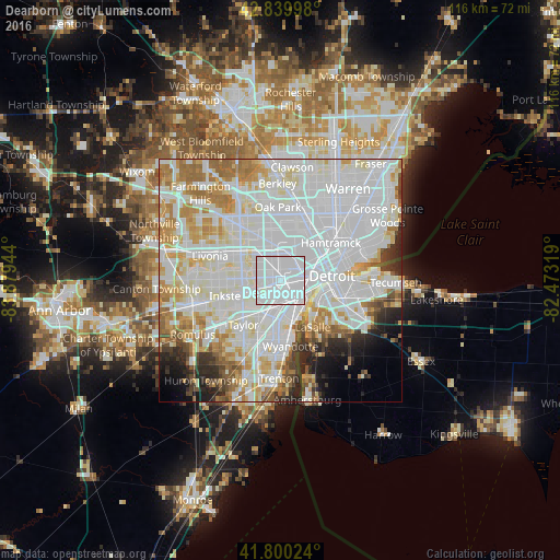
Analysis of Dearborn night lights 2016
Square area 10x10 km:
 87.12%
90-99
12.27%80-89
0.61%70-79
0%60-69
0%50-59
0%40-49
0%30-39
0%20-29
0%10-19
0%0-9
0%Square area 50x50 km:
34.8%90-99
21.88%80-89
6.66%70-79
6.76%60-69
6.51%50-59
3.37%40-49
2.63%30-39
2.42%20-29
4.2%10-19
3.58%0-9
7.19%Clear (daylight) street map image can be seen on geolist.org.
Map coordinates:
42° 50' 23.9" North, 83° 52' 46" West
42° 19' 20.1" North, 83° 10' 34.7" West
41° 48' 0.9" North, 82° 28' 23.5" West
Some cities around Dearborn sort by population:
• Detroit
10.8 km =6.7 mi,  84°
84°
• Lincoln Park
8 km =5 mi,  181°
181°
• Allen Park
7.7 km =4.8 mi,  201°
201°
• Inkster
11.4 km =7.1 mi,  254°
254°
• Highland Park
11.3 km =7 mi,  35°
35°
• Melvindale
4.4 km =2.7 mi, 178°
• Ecorse
9 km =5.6 mi,  163°
163°
• River Rouge
6.4 km =4 mi,  147°
147°
4990510 (p: 95,171)
Sources (retrieved 2019-11-25):
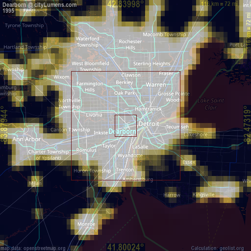
» NASA, Earths city lights 1995
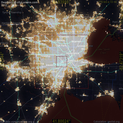
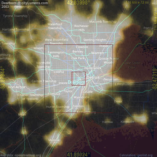
» NASA city lights 2003
» Earth at Night: Flat Maps 2012, 2016