Costa Mesa night lights from space
Night Light of Costa Mesa (California) from space (United States) Src. Average luminocity for 10x10km area is 81.1392% and for 50x50km: 48.0027%.
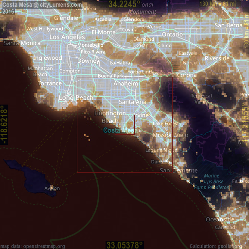
Analysis of Costa Mesa night lights 2016
Square area 10x10 km:
 26.74%
90-99
25.09%80-89
15.38%70-79
11.72%60-69
4.76%50-59
2.93%40-49
2.01%30-39
1.83%20-29
7.33%10-19
2.2%0-9
0%Square area 50x50 km:
17.33%90-99
13.49%80-89
4.23%70-79
4.71%60-69
5.96%50-59
4.17%40-49
3.18%30-39
2.3%20-29
4.08%10-19
5.81%0-9
34.76%Clear (daylight) street map image can be seen on geolist.org.
Map coordinates:
34° 13' 28.2" North, 118° 37' 18.5" West
33° 38' 28.1" North, 117° 55' 7.2" West
33° 3' 13.6" North, 117° 12' 56" West
Some cities around Costa Mesa sort by population:
• Santa Ana
12.5 km =7.8 mi,  22°
22°
• Irvine
9.4 km =5.8 mi,  70°
70°
• Huntington Beach
7.8 km =4.8 mi,  285°
285°
• Garden Grove
14.9 km =9.3 mi,  351°
351°
• Newport Beach
2.6 km =1.6 mi,  201°
201°
• Tustin
14.5 km =9 mi,  36°
36°
• Fountain Valley
8.2 km =5.1 mi,  336°
336°
• Midway City
13.2 km =8.2 mi,  330°
330°
5339840 (p: 113,204)
Sources (retrieved 2019-11-25):
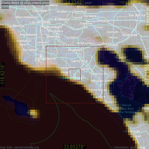
» NASA, Earths city lights 1995
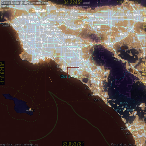
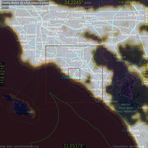
» NASA city lights 2003
» Earth at Night: Flat Maps 2012, 2016