Belle Isle night lights from space
Night Light of Belle Isle (Florida) from space (United States) Src. Average luminocity for 10x10km area is 95.6944% and for 50x50km: 73.6302%.
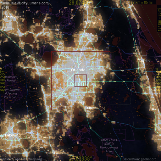
Analysis of Belle Isle night lights 2016
Square area 10x10 km:
 50.2%
50.2%90-99
29.76%80-89
17.86%70-79
2.18%60-69
0%50-59
0%40-49
0%30-39
0%20-29
0%10-19
0%0-9
0%Square area 50x50 km:
23.88%90-99
22.56%80-89
9.3%70-79
10.1%60-69
8.73%50-59
4.22%40-49
3.73%30-39
3.88%20-29
3.36%10-19
3.5%0-9
6.75%Clear (daylight) street map image can be seen on geolist.org.
Map coordinates:
29° 4' 28.9" North, 82° 3' 44.5" West
28° 27' 30" North, 81° 21' 33.3" West
27° 50' 18.2" North, 80° 39' 22" West
Some cities around Belle Isle sort by population:
• Orlando
9.1 km =5.7 mi,  347°
347°
• Meadow Woods
8.1 km =5 mi,  184°
184°
• Oak Ridge
6.5 km =4 mi,  282°
282°
• Southchase
7.6 km =4.7 mi,  198°
198°
• Conway
5.7 km =3.5 mi,  29°
29°
• Pine Castle
1.7 km =1.1 mi,  330°
330°
• Williamsburg
9.5 km =5.9 mi,  239°
239°
• Sky Lake
3.2 km =2 mi,  267°
267°
4147247 (p: 6,689)
Sources (retrieved 2019-11-25):
» Earth at Night: Flat Maps 2012, 2016