Coral Springs night lights from space
Night Light of Coral Springs (Florida) from space (United States) Src. Average luminocity for 10x10km area is 84.3393% and for 50x50km: 48.8907%.
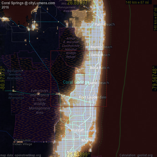
Analysis of Coral Springs night lights 2016
Square area 10x10 km:
 34.72%
90-99
29.96%80-89
7.74%70-79
2.38%60-69
4.76%50-59
7.54%40-49
7.94%30-39
2.78%20-29
2.18%10-19
0%0-9
0%Square area 50x50 km:
22.22%90-99
13.53%80-89
3.56%70-79
2.59%60-69
3.43%50-59
2.77%40-49
3.05%30-39
3.44%20-29
4.24%10-19
6.37%0-9
34.8%Clear (daylight) street map image can be seen on geolist.org.
Map coordinates:
26° 53' 59.9" North, 80° 58' 25.4" West
26° 16' 16.3" North, 80° 16' 14.2" West
25° 38' 20.4" North, 79° 34' 2.9" West
Some cities around Coral Springs sort by population:
• Tamarac
6.8 km =4.2 mi,  162°
162°
• Coconut Creek
9.4 km =5.8 mi,  103°
103°
• Margate
7.1 km =4.4 mi,  114°
114°
• North Lauderdale
7.5 km =4.7 mi,  143°
143°
• Lauderdale Lakes
13.2 km =8.2 mi,  151°
151°
• Parkland
5.5 km =3.4 mi,  37°
37°
• Boca Del Mar
14.8 km =9.2 mi,  56°
56°
• Sandalfoot Cove
11.2 km =7 mi,  48°
48°
4151909 (p: 129,485)
Sources (retrieved 2019-11-25):
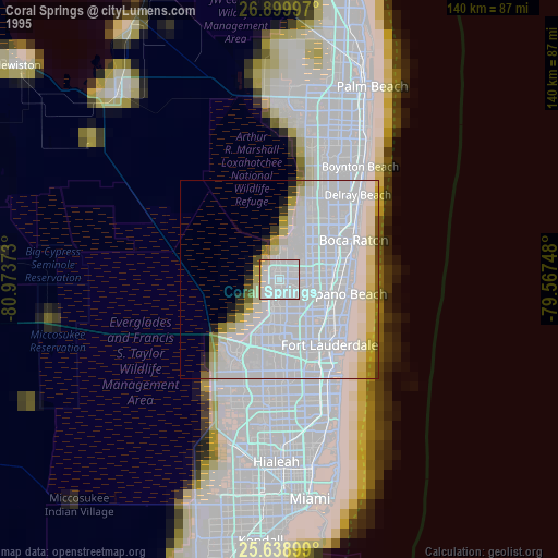
» NASA, Earths city lights 1995
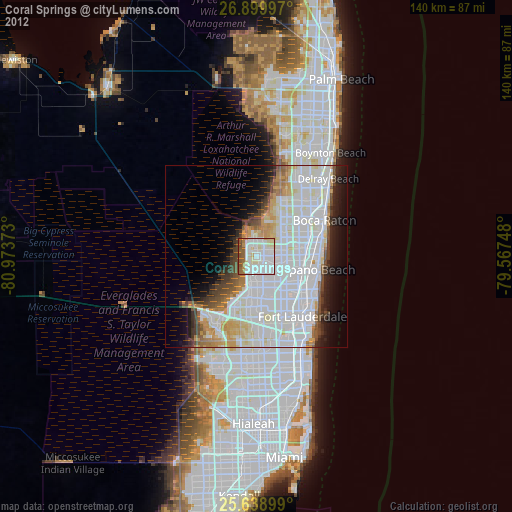
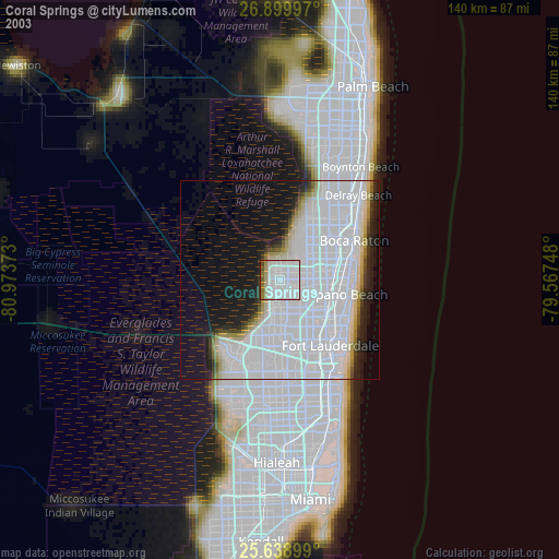
» NASA city lights 2003
» Earth at Night: Flat Maps 2012, 2016