Shelby night lights from space
Night Light of Shelby (Michigan) from space (United States) Src. Average luminocity for 10x10km area is 72.5348% and for 50x50km: 49.1918%.
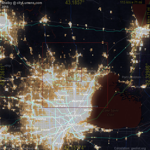
Analysis of Shelby night lights 2016
Square area 10x10 km:
 11.97%
90-99
12.42%80-89
9.39%70-79
14.39%60-69
25.3%50-59
19.85%40-49
3.79%30-39
2.88%20-29
0%10-19
0%0-9
0%Square area 50x50 km:
13.61%90-99
11.74%80-89
5.87%70-79
7.09%60-69
8.45%50-59
5.48%40-49
3.22%30-39
3.37%20-29
5.31%10-19
7.41%0-9
28.43%Clear (daylight) street map image can be seen on geolist.org.
Map coordinates:
43° 11' 8.5" North, 83° 44' 10" West
42° 40' 15.1" North, 83° 1' 58.7" West
42° 9' 6.3" North, 82° 19' 47.5" West
Some cities around Shelby sort by population:
• Sterling Heights
10.1 km =6.3 mi,  178°
178°
• Clinton Township
13.1 km =8.1 mi,  135°
135°
• Troy
12 km =7.5 mi,  232°
232°
• Rochester Hills
9.7 km =6 mi,  261°
261°
• Auburn Hills
16.5 km =10.3 mi,  276°
276°
• Mount Clemens
15.1 km =9.4 mi,  122°
122°
• Fraser
16.2 km =10.1 mi,  154°
154°
• Rochester
8.3 km =5.2 mi, 277°
5009586 (p: 74,099)
Sources (retrieved 2019-11-25):
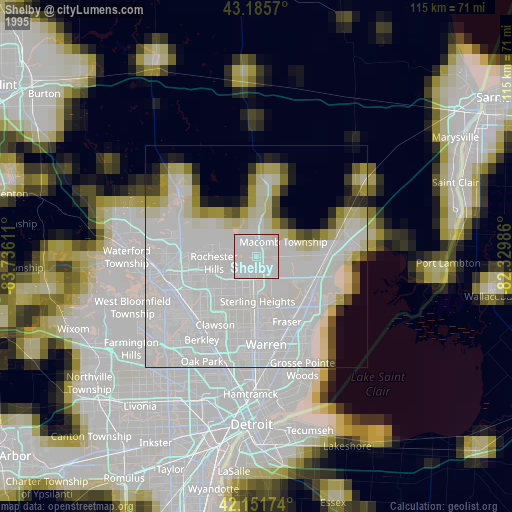
» NASA, Earths city lights 1995
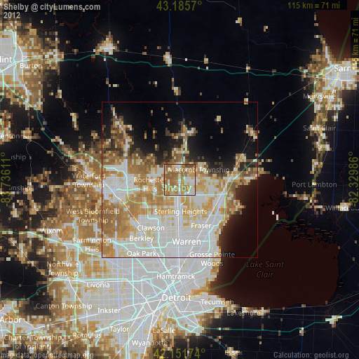
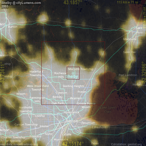
» NASA city lights 2003
» Earth at Night: Flat Maps 2012, 2016