Chapel Hill night lights from space
Night Light of Chapel Hill (North Carolina) from space (United States) Src. Average luminocity for 10x10km area is 67.7656% and for 50x50km: 37.6826%.
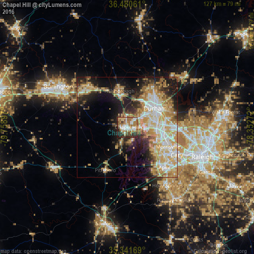
Analysis of Chapel Hill night lights 2016
Square area 10x10 km:
 14.1%
14.1%90-99
15.93%80-89
8.24%70-79
8.24%60-69
19.23%50-59
6.78%40-49
7.88%30-39
8.79%20-29
9.71%10-19
1.1%0-9
0%Square area 50x50 km:
6.96%90-99
7.13%80-89
7.37%70-79
6.85%60-69
6.16%50-59
2.86%40-49
2.96%30-39
4.71%20-29
6.33%10-19
12.32%0-9
36.34%Clear (daylight) street map image can be seen on geolist.org.
Map coordinates:
36° 28' 50.2" North, 79° 45' 32.3" West
35° 54' 47.5" North, 79° 3' 21" West
35° 20' 30.1" North, 78° 21' 9.8" West
Some cities around Chapel Hill sort by population:
• Durham
16.8 km =10.4 mi,  57°
57°
• Cary
28.2 km =17.5 mi,  118°
118°
• Apex
27.3 km =17 mi,  137°
137°
• Holly Springs
35.4 km =22 mi,  145°
145°
• Morrisville
23 km =14.3 mi, 115°
• Carrboro
1.8 km =1.1 mi,  259°
259°
• Mebane
27.8 km =17.3 mi,  316°
316°
• Hillsborough
18.5 km =11.5 mi,  347°
347°
4460162 (p: 59,568)
Sources (retrieved 2019-11-25):
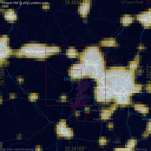
» NASA, Earths city lights 1995
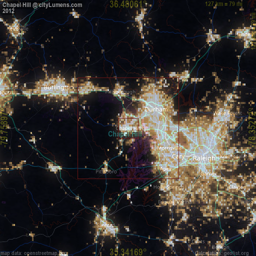
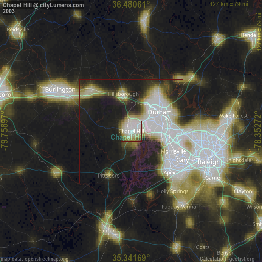
» NASA city lights 2003
» Earth at Night: Flat Maps 2012, 2016