Morrisville night lights from space
Night Light of Morrisville (North Carolina) from space (United States) Src. Average luminocity for 10x10km area is 91.5542% and for 50x50km: 58.9987%.
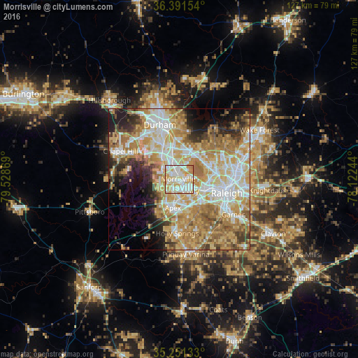
Analysis of Morrisville night lights 2016
Square area 10x10 km:
 29.55%
90-99
32.69%80-89
24.13%70-79
12.41%60-69
1.22%50-59
0%40-49
0%30-39
0%20-29
0%10-19
0%0-9
0%Square area 50x50 km:
12.09%90-99
12.14%80-89
11.95%70-79
11.77%60-69
11.67%50-59
5.27%40-49
3.9%30-39
4.45%20-29
5.29%10-19
6.8%0-9
14.68%Clear (daylight) street map image can be seen on geolist.org.
Map coordinates:
36° 23' 29.5" North, 79° 31' 43.3" West
35° 49' 24.5" North, 78° 49' 32" West
35° 15' 4.8" North, 78° 7' 20.8" West
Some cities around Morrisville sort by population:
• Raleigh
17.8 km =11.1 mi,  108°
108°
• West Raleigh
15.1 km =9.4 mi, 105°
• Durham
20.1 km =12.5 mi,  340°
340°
• Cary
5.4 km =3.4 mi,  131°
131°
• Chapel Hill
23 km =14.3 mi,  295°
295°
• Apex
10.3 km =6.4 mi,  192°
192°
• Holly Springs
19.2 km =11.9 mi,  182°
182°
• Garner
22.8 km =14.2 mi,  123°
123°
4480285 (p: 23,820)
Sources (retrieved 2019-11-25):
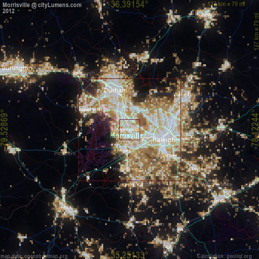
» Earth at Night: Flat Maps 2012, 2016