Holly Springs night lights from space
Night Light of Holly Springs (North Carolina) from space (United States) Src. Average luminocity for 10x10km area is 68.9843% and for 50x50km: 42.1543%.
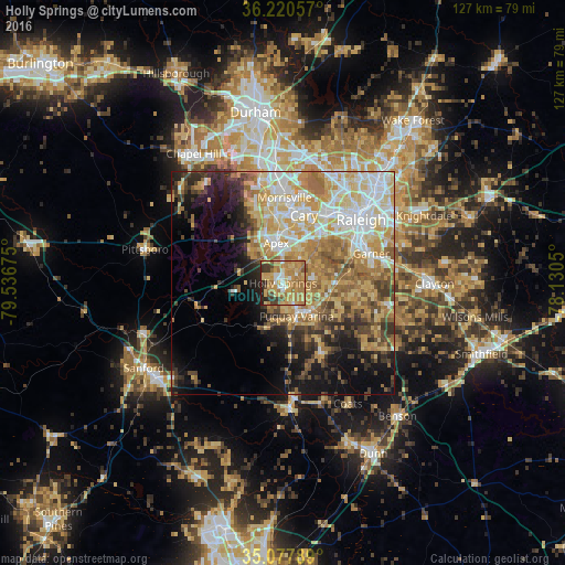
Analysis of Holly Springs night lights 2016
Square area 10x10 km:
 5.59%
5.59%90-99
6.12%80-89
19.76%70-79
23.25%60-69
25%50-59
3.67%40-49
4.02%30-39
6.29%20-29
6.29%10-19
0%0-9
0%Square area 50x50 km:
7.17%90-99
7.26%80-89
9.09%70-79
8.11%60-69
7.77%50-59
4.25%40-49
4.38%30-39
4.54%20-29
5.57%10-19
9.8%0-9
32.06%Clear (daylight) street map image can be seen on geolist.org.
Map coordinates:
36° 13' 14.1" North, 79° 32' 12.3" West
35° 39' 4.6" North, 78° 50' 1" West
35° 4' 40.4" North, 78° 7' 49.8" West
Some cities around Holly Springs sort by population:
• Raleigh
22.1 km =13.7 mi,  52°
52°
• West Raleigh
21.5 km =13.4 mi, 45°
• Cary
16.3 km =10.1 mi,  16°
16°
• Apex
9.2 km =5.7 mi,  350°
350°
• Garner
20.9 km =13 mi,  71°
71°
• Fuquay-Varina
8 km =5 mi,  157°
157°
• Morrisville
19.2 km =11.9 mi,  2°
2°
• Clayton
34.1 km =21.2 mi,  90°
90°
4471641 (p: 31,377)
Sources (retrieved 2019-11-25):
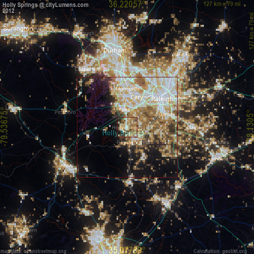
» Earth at Night: Flat Maps 2012, 2016