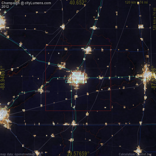
Champaign night lights from space
Night Light of Champaign (Illinois) from space (United States) Src. Average luminocity for 10x10km area is 85.8166% and for 50x50km: 9.5707%.

Analysis of Champaign night lights 2016
Square area 10x10 km:
 32.31%
90-99
31.01%80-89
9.58%70-79
6.01%60-69
6.17%50-59
4.55%40-49
5.03%30-39
3.9%20-29
1.46%10-19
0%0-9
0%Square area 50x50 km:
1.62%90-99
1.71%80-89
1.53%70-79
0.87%60-69
1.26%50-59
0.91%40-49
1.21%30-39
1.1%20-29
2.15%10-19
5.63%0-9
82.01%Clear (daylight) street map image can be seen on geolist.org.
Map coordinates:
40° 39' 7.2" North, 88° 56' 47.4" West
40° 6' 59.1" North, 88° 14' 36.2" West
39° 34' 35.7" North, 87° 32' 24.9" West
Some cities around Champaign sort by population:
• Urbana
3.1 km =1.9 mi,  101°
101°
• Danville
52.2 km =32.4 mi,  89°
89°
• Rantoul
22.6 km =14 mi,  19°
19°
• Savoy
6.9 km =4.3 mi,  185°
185°
• Mahomet
16.2 km =10.1 mi,  302°
302°
• Clinton
61.4 km =38.2 mi,  273°
273°
• Monticello
29.8 km =18.5 mi,  250°
250°
• Hoopeston
62.5 km =38.8 mi,  51°
51°
4887158 (p: 86,096)
Sources (retrieved 2019-11-25):
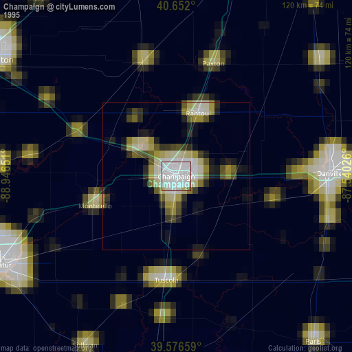
» NASA, Earths city lights 1995
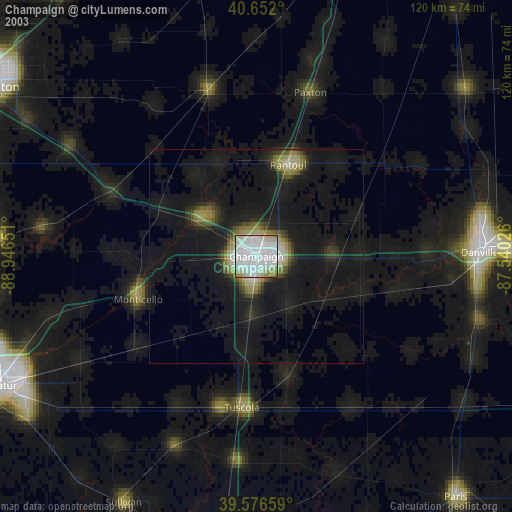
» NASA city lights 2003
» Earth at Night: Flat Maps 2012, 2016