Marysville night lights from space
Night Light of Marysville (Washington) from space (United States) Src. Average luminocity for 10x10km area is 44.5071% and for 50x50km: 14.0647%.
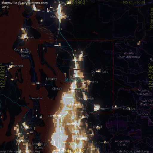
Analysis of Marysville night lights 2016
Square area 10x10 km:
 6.11%
6.11%90-99
7.39%80-89
5.11%70-79
6.68%60-69
4.69%50-59
6.96%40-49
6.53%30-39
6.11%20-29
29.97%10-19
16.62%0-9
3.84%Square area 50x50 km:
2.68%90-99
2.8%80-89
1.25%70-79
2.03%60-69
1.81%50-59
1.7%40-49
1.38%30-39
1.91%20-29
4.76%10-19
6.73%0-9
72.94%Clear (daylight) street map image can be seen on geolist.org.
Map coordinates:
48° 31' 10.7" North, 122° 52' 48.8" West
48° 3' 6.3" North, 122° 10' 37.5" West
47° 34' 46.6" North, 121° 28' 26.3" West
Some cities around Marysville sort by population:
• Everett
8.3 km =5.2 mi,  192°
192°
• Lake Stevens
9.4 km =5.8 mi,  115°
115°
• Mukilteo
15.2 km =9.4 mi,  218°
218°
• West Lake Stevens
8.6 km =5.3 mi,  139°
139°
• Eastmont
17.2 km =10.7 mi,  181°
181°
• Arlington
16.8 km =10.4 mi,  13°
13°
• Snohomish
16.5 km =10.3 mi,  159°
159°
• Tulalip
8.7 km =5.4 mi,  282°
282°
5802570 (p: 66,773)
Sources (retrieved 2019-11-25):
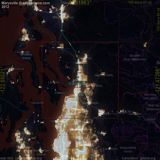
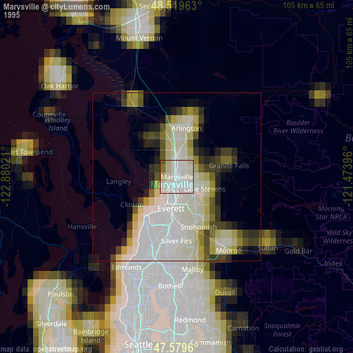
» NASA, Earths city lights 1995
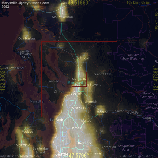
» NASA city lights 2003
» Earth at Night: Flat Maps 2012, 2016