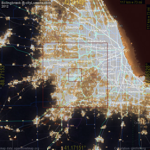
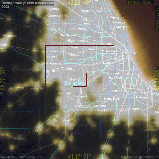
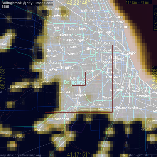
Bolingbrook night lights from space
Night Light of Bolingbrook (Illinois) from space (United States) Src. Average luminocity for 10x10km area is 91.8117% and for 50x50km: 79.437%.
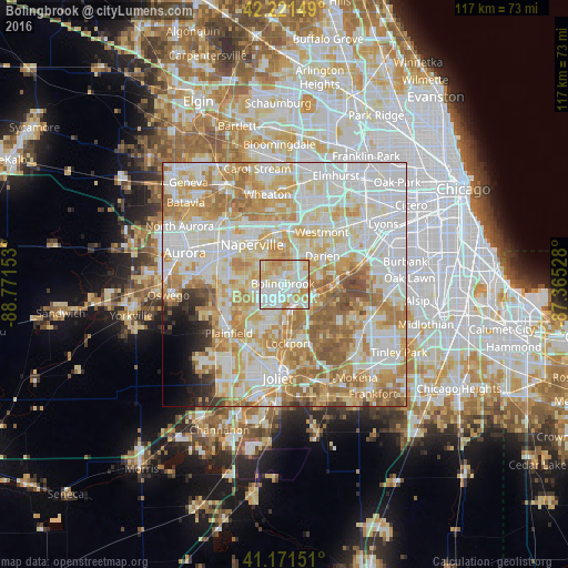
Analysis of Bolingbrook night lights 2016
Square area 10x10 km:
 32.63%
90-99
32.63%80-89
16.07%70-79
16.56%60-69
2.11%50-59
0%40-49
0%30-39
0%20-29
0%10-19
0%0-9
0%Square area 50x50 km:
23.27%90-99
22.18%80-89
14.1%70-79
13.26%60-69
11.88%50-59
5.85%40-49
1.69%30-39
1.44%20-29
1.57%10-19
1.85%0-9
2.92%Clear (daylight) street map image can be seen on geolist.org.
Map coordinates:
42° 13' 17.4" North, 88° 46' 17.5" West
41° 41' 55.1" North, 88° 4' 6.2" West
41° 10' 17.4" North, 87° 21' 55" West
Some cities around Bolingbrook sort by population:
• Naperville
11.7 km =7.3 mi,  325°
325°
• Downers Grove
13.1 km =8.1 mi,  21°
21°
• Romeoville
5.9 km =3.7 mi,  197°
197°
• Woodridge
5.6 km =3.5 mi, 15°
• Lockport
12.2 km =7.6 mi,  175°
175°
• Lisle
11.4 km =7.1 mi,  357°
357°
• Darien
9.8 km =6.1 mi,  52°
52°
• Lemont
6.2 km =3.9 mi,  116°
116°
4885265 (p: 74,306)
Sources (retrieved 2019-11-25):
» NASA, Earths city lights 1995
» NASA city lights 2003
» Earth at Night: Flat Maps 2012, 2016